State budgetary educational institution secondary general education school p.g.t. Balasheyka
Section Geography
"The role of water as a source of life on Earth"
Completed by 5th grade students
Aryapova Ksenia, Konyukhova Kristina,
Poselenova Olga, Tkhor Elizaveta
Supervisor
geography teacher Sidorova V.M.
Job protected
2013-2014 academic year
Content
Introduction …………………………………………………………
…………………..
1.1.Blueplanet……………………………………………
1.2. The first living organisms…………………………………
2. Water is the priceless moisture of life…………………………………
2.1. Water is an integral part of all living organisms………….
2.2. Water and human health………………………………….
3. Unique properties of water /experiments/…………………………
4.Water in danger!............................................... ...................
5. Why should water be conserved?/experiment/.......................
Conclusion………………………………………………………
List of used literature…………………………
Appendix………………………………………………………
Introduction
There is no better drink on earth
than a glass of clean cold water.
V. Peskov.
Water is the most common substance in our life. FROM
scientific point water is the most unusual, very mysterious
liquid.
What is the peculiarity of water?
Water is one of the main resources on earth. It's hard to imagine that
what would happen to our planet if fresh water disappeared. And such a threat
exists. All living things suffer from polluted water, it is harmful to life
person.
Problem: Is water infinite and should it be conserved?
Object of study: water.
Subject of study : respect for water.
The purpose of the research work :
To prove that water is one of the unique and valuable resources needed
to all life on earth.
Tasks:
Select and study literature on the topic.
Collect and analyze information from Internet sources.
3.Find out where the water came from.
4. Find out how much water there is on Earth and what kind it is in nature.
5.Find out who needs water and why, whether it is possible to live without water.
6. Find out whether water sources are exhaustible, whether they need to be protected.
7. Conduct practical experiments, experiments with water to study it
properties and cost savings.
Work plan:
1. Study the literature on the topic.
2. Monitor your houseplants and seeds.
3. Conduct experiments with water.
4. Process the material.
5. Draw conclusions.
Methods:
Practical: experiments, observation, practical analysis.
Theoretical: study of sources of information.
Equipment: multimedia projector, computer, presentation.
Relevance work lies in the meaning of pure water: where water -
there is life. We are the ones who have to live and work in the third millennium
On the Earth. Already today we are disturbed by the information that we breathe
dirty air, we eat food contaminated with foreign impurities and
drink the same bad water. In the 21st century, the problem of rational
use and protection of water resources is becoming one of the most
acute both throughout the world and in Russia. It is very important to learn to observe
nature. To be able to take care of water sources means to become
indifferent to the world in which we live. be able to see how
The life of our planet depends on water resources.
Hypothesis:
If we know more about the meaning of water and tell others, then
we will treat the water very carefully. This statement will answer
the main question: "Why can't there be life on Earth without water?"
Questions guiding the project
Fundamental question
1. Why do we need water?
Problematic issues of educational
themes
2. Why is water called a source
life?
What is unique about water?
What kind environmental problems connected
with water?
Study questions
What is the importance of water to humans? Why do plants need water? For whom is water a natural home?
Can you enjoy water?
What properties does water have? What miraculous transformations occur with water?
What is more on the earth's surface: land or water? Do you know what water is called fresh? How much water does one family use per day? What can pollution of water bodies lead to? How to save water?
1. Water is the greatest wealth on Earth.
“Water, you have no taste, no color, no smell, you cannot be described, you are enjoyed without knowing what you are. It cannot be said that you are necessary for life: you are life itself. You fill us with joy beyond our senses. With you, the forces with which we have already said goodbye return to us. By your mercy, the dried-up springs of our hearts begin to seethe in us again. You are the greatest wealth in the world” [Antoine de Saint-Exupery]. Without water, our planet would remain dead and lifeless, like other planets in the solar system.
Where did she come from?
1.1 . Blue planet.
Water existed in the Universe in the form of ice or steam long before the formation of our planet. She settled on dust particles and pieces of cosmic particles. From the combination of these materials, the Earth was formed, and water formed an underground ocean in the very center of the planet. Volcanoes and geysers have shaped our young planet for millennia. They spewed fountains from the bowels of the Earth hot water, a large number of steam and gases. This steam enveloped our planet like a blanket. Another part of the water came to us from space in the form of huge blocks of ice, which were the tails of huge comets that bombarded our young planet.
The surface of the Earth gradually cooled. The water vapor began to turn into a liquid. The rains fell on our planet, filling the future oceans with a seething dirty water. It took many years for the oceans to cool, clear up, and become what we know them today: salty, blue expanses of water that cover most of the Earth's surface. That is why the earth is called – BLUE PLANET.
The only planet in the solar system where life originated is our Earth. There are many opinions on the origin of life on Earth, but they all agree that water was the basis for the origin of life..
1.2. The first living organisms.
Most of the volcanoes were flooded by the waters of the first ocean. But volcanoes continued to erupt under water, supplying heated water and minerals dissolved in it from the bowels of the Earth. And there, at an amazing depth, near volcanoes, according to many scientists, life originated.
The very first living organisms were bacteria and blue-green algae. They do not need sunlight to live, they existed thanks to volcanic heat and minerals dissolved in water. But how did they withstand such high temperatures emanating from volcanoes?
At present, in the depths of the ocean, as many centuries ago, there are amazing hot springs that smoke with white and black steam, they are called underwater smokers. Near them live many species of marine animals that have adapted to this environment and, of course, bacteria.
But how did the first living organisms appear?
Scientists have discovered in space a large number of molecules (these are the “bricks” of which all living and non-living things are composed) from which the first living organisms could form. On our planet, they could get along with water. Or maybe not molecules, but bacteria came to us from outer space? They constantly surprise people with their ability to go through fire and water.
They have been found in Egyptian mummies and in the nose of a mammoth. IN oil well and the ice of Antarctica at a depth of four kilometers. They were found at a nuclear power plant in the water. All of them were alive, healthy and continued to multiply.
Or maybe life on Earth originated simultaneously in different ways? Until the end, this mystery of nature is not disclosed. One thing is for sure: on Earth there was everything necessary for the origin of life, only the conditions for their connection were needed. Sea water has become these favorable conditions for the origin of life and its development. And underwater volcanoes provided heat and food.
2. Water is the priceless moisture of life.
At all times, water was considered the priceless moisture of life. And although
far behind those years when it was necessary to take it in rivers, ponds, lakes
and carry for several kilometers to the house on the yokes, trying not to
splash a drop, the man still takes care of the water,
taking care of the cleanliness of natural reservoirs, the good condition of wells,
columns, plumbing systems.
Due to the constantly growing needs of industry and agriculture
farms in fresh water, the problem of preserving
existing water resources. After all, fit for needs human water,
as statistics show, not so much on the globe.
It is known that more than 70% of the Earth's surface is covered with water. About 95% of it
falls on the seas and oceans, 4% - on the ice of the Arctic and Antarctic, and
only 1% is fresh water from rivers and lakes. Significant water sources
are underground, sometimes at great depths.
About 4.5 thousand km3 - a sea of water - this is the annual flow of our rivers. but
water resources are unevenly distributed throughout the country.
Consumers, using water, pollute it, this gradually leads to
depletion of clean fresh waters and the need to take measures to
protection.
Such water use, without affecting the amount of water, significantly
affects its quality.
2.1. Water is an integral part of all living organisms.
« Water stands apart in the history of our planet. No natural
a body that could be compared with it in terms of its influence on the course of the main,
the most grandiose geological processes. Not only earthly
surface, but also deep - on the scale of the biosphere - parts of the planet
are determined, in their most significant manifestations, by its
existence and its properties" [ V. I. Vernadsky].
Covering two-thirds of the Earth's surface, water affects almost everything
processes that take place on our planet. It's hard to find this
a natural body that does not contain water. They even contain moisture
stones and fiery magma. The plant world consists of 70-95% water.
The role of water in the life of nature is great: there is no life without water. live
organisms of our planet have adapted to all conditions: to complete
darkness and great pressure at the bottom of the oceans; to 70-degree heat in
deserts and to 70-degree cold in Siberia and Antarctica. But none
Living being cannot do without water.
In order to make sure of the importance and necessity of water, we conducted
a few experiences:
What happens to a flower if it is not watered:
He withered after 5 days.
Then poured And his water.
The next day it bloomed again.
INode gives new life.
1.B take cucumber seed.
2.By lay down him in saucer on damp cloth.
3. Wet the cloth daily water.
4. After three days, the seed germinated.
All plants and animals contain water, and our own body
70-75% water, our brains are 90% water, and blood is
by 95%. Without it, there can be neither bright flowers, nor green trees, nor
the singing of birds, nor the golden fields of wheat.
Did you know that when a person loses 1-1.5 liters of water (this is 2% of the mass
body) there is a feeling of thirst. When the body loses 6-8% of moisture
the person falls into a semi-conscious state. Loss of 10% of water causes
hallucinations, the swallowing reflex is disturbed. If water loss
exceeds 12%, the person dies.
2.2.Water and human health.
Water is the most unique and mysterious natural formation. This
the only natural mineral that is found in three aggregate
states: solid, liquid and gaseous, in addition, it is
the best energy-information carrier. All living organisms are more
than half are water, for example, fish and animals - 75%,
jellyfish - by 99%, apples - by 85%, cucumbers - by 95%, but the body
an elderly person is 50% water, and the body of a newborn is 86%.
According to statistics World Organization health care about
85% of diseases are transmitted by water. In human life, water is not
fungible natural resource, much more than oil, gas, coal,
iron.
In the human body, water performs many functions: it helps
absorb nutrients, convert food into energy,
contributes to the regulation of body temperature, lubricates the joints, removes
waste from the body. Scientific blood tests have confirmed that
the cause of many diseases is dehydration of the body, which leads to
acidification of the blood. To keep the body and its organs healthy
it is necessary to use as much pure unboiled water as possible.
Drinking water can be compared to wet cleaning of the body,
cleansing it of toxins and toxins. During the day, a person loses up to
two liters of water, which means that he needs to drink the same amount. In the morning, as soon as we wake up, we must "start" the body, drink 2 glasses of water. It helps us to look more well-groomed, healthy and beautiful. Sufficient water intake is the prevention of many diseases.
3. Unique properties of water.
Water is such a unique solvent that it has every right to
to the most respectful attitude. Liquids dissolve in water, solids
substances and gases.
3.1. Water is a solvent.
Experience number 1.
Pour pure salt into a glass of water and stir it with a spoon.
Let's observe what happens to salt crystals. They become everything
less and less. Soon they will disappear completely. But has the salt disappeared?
Let's try the water. The salt has not disappeared. She dissolved into the water. What can
draw a conclusion? Water is a solvent. Take a rock and put it in water.
Has the stone dissolved? No. What can be the conclusion? In nature there is
substances that are soluble and insoluble in water.
3.2. Fluidity of water.
Experience number 2.
Can you put water on the table? No, the water will spill on the table. If
pour water into a glass, it will take the shape of a glass. If you fill it
bubble, it will take the form of a bubble. Water is a liquid. The liquid has no
its form, but takes the form of the vessel in which it is located. Doing
conclusion: water is fluid, has no shape.
3.3. The water is transparent.
Experience number 3.
Dip a spoon into a glass of water, and then a spoon into a glass of milk.
CompareCan you see the spoon in the glass of water? And in milk? This speaks of
that the watertransparent.
3.4. Water is colorless.
Experience number 4.
Compare the color of water with the color of milk. Does water have color? BUT
milk? Thisindicates that the water is colorless.
3.5. Odorless water.
Experience number 5.
Smell the water and determine if it smells? Does not have, but gasoline,
oriodine? This means that the water is odorless.
3.6. Capillarity.
In addition to these properties, water also has one of the most unique
properties - capillarity. Many of the physical bodies around us have
porous structure, that is, penetrated by thin capillaries. Exactly
therefore, towels, cotton wool, paper, wood absorb moisture well.
Using this property, capillarity, we will show you ...
Experience number 6.
Wet a piece of sugar in a glass of tea. Everything is creeping up
it is a brown liquid, white sugar turns brown, settles, spreads.
For this experiment you will need five matches.
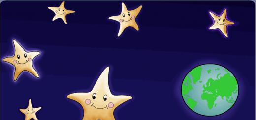
Let's break them all in the middle, bend them at an acute angle and put them on
saucer as shown in the picture on the left. How to make from these matches
five-pointed star without touching them? And here you need to drop
a few drops of water on the folds of matches! Gradually the matches will start
straighten out and form a star.
The reason for both experiments is the same.
Wood fibers absorb moisture. She crawls further and further along the capillaries.
The tree swells. Its surviving fibers "get fat". Becoming fat, they
they cannot bend and straighten so much.
/This is how plants are fed from the soil/.
4.Water in danger!
Wastewater from industrial enterprises. What are they? (dirty and
bad smell). If you add dirty water to a glass of clean water.
What happens to clean water? Can it be used now
man? Can animals live in such water? This water cannot be drunk.
Many marine animals die from oil pollution of the seas. Human,
like all living organisms, may soon be left without clean water, if not
take measures to protect the water.
The protection of water is a condition for the preservation of life on Earth. Fresh water
makes up only about 3% of the Earth's water resources, and available to people
rivers, lakes and swamps account for only 0.3% of fresh water. That's why
We need to conserve clean water. The population of our planet is growing, growing
water costs. With the development of industry around the world, there is
pollution of rivers, lakes with harmful substances.
Clean and fresh water
we really need it right now!
Like air to a man
Like animal food.
Like the sun in the sky
We need water!
If there is no clean water,
Then all the rivers and ponds will perish.
All nations will perish...
Save water people!
5. Why water should be conserved.
Water on Earth is both abundant and scarce at the same time. It is abundant in the oceans and
seas, but sea salt water is undrinkable, and also for many
technical industries Agriculture. Fresh water essential
less than a third of the world's population is experiencing an acute shortage of it.
Limited fresh water supplies are further reduced due to their
pollution.
To view a presentation with pictures, design, and slides, download its file and open it in PowerPoint on your computer.
Text content of presentation slides: Rocks and minerals of Karachay-Cherkessia An example of a project for students in grade 6 Aims of the work To study the rocks of the KChR and identify their role for the development of industry. Consider rare and unique rocks on the territory of the KChR. Igneous rocks Copper. The color in a fresh fracture is light pink, but quickly turns to copper-red, then to red-brown. Often there are green, brown or black plaques, as well as brown, yellow or variegated tarnish on the surface. Often, the discharge of native copper is covered with a green (malachite), blue (lapis lazuli) or black (sulfide) coating of change products. The line is copper-red, shiny, with a metallic sheen. bright metallic Hardness 2.5-3 (cut with a knife). Very forging, malleable. Specific gravity 8.4-8.9. Silver. The color in a fresh break is silvery white, but the pure color of native silver in nature can only be seen occasionally, as it is very quickly covered with a black or gray coating. Trait - silvery white with a metallic sheen Shine - bright, metallic Hardness 2.5-3 (easily cut with a knife) Density 9.6-12 Specific gravity 10.1-11.1 Ductile, plastic, drawn into a thin wire, flattened into the thinnest leaves Quartz. The color is varied, often due to the finest impurities of other minerals; gray is the most common. The milky-white color of quartz in the veins is associated with an abundance of the smallest cracks and is observed only near the daylight surface. In crystals, the top and peripheral zone are often colored more intensely than the central parts. The luster is glassy, sometimes greasy in solid masses. The fracture is uneven, conchoidal. Hardness 7. Specific gravity 2.60 (milky white) - 2.65 Calcite. Mostly colorless or milky white. Due to impurities, it is painted in light pink, blue, yellow, brown and other tones. Glass luster. Hardness 3. Brittle. Specific gravity 2.6-2.8 Dolomite. greenish tint. Glass luster. Hardness 3.5-4. Specific gravity 2.8-2.9. Barite. Dense, fine-grained or earthy aggregates that fill cracks and form ore-bearing veins, also sinter forms, stalactites, etc. Druses of barite crystals are found in the voids of the veins. The crystals are tabular, less often prismatic and columnar. The mineral in its pure form is colorless, water-transparent, due to impurities it is often colored gray, bluish-gray, greenish, yellow, meat-red or black. Glass luster, on cleavage planes - mother-of-pearl. Hardness 3-3.5. Fragile. Specific gravity 4.3-4.5. Scheelite. Named after the Swedish chemist K. V. Scheele (XVIII century), who discovered the presence of tungsten in this mineral. The color is yellowish-gray, pale yellow, sometimes has a brownish, reddish, orange or greenish tint; rarely colorless or white. White streak. Glass luster, greasy to diamond. Transparent. Hardness 4.5. Brittle The origin is igneousComposition of granite: feldspars - 60-65% (orthoclase and plagioclase, the former predominating), quartz - 25-30% and dark-colored minerals - 5-10% (mainly biotite, much less often hornblende). Color gray, yellowish, pinkish-gray to pink and meat red. High hardness. Slate. Siliceous shale is characterized by platy separation. The color in the absence of impurities is white, light gray, bluish; due to the admixture of carbonaceous matter - dark gray to black. Urupskoe copper-nickel deposit In terms of reserves, this is a medium-sized deposit, its ores contain an average of 2.7% copper and 1.19% zinc. The ore contains as by-products: gold, silver, cadmium, selenium, tellurium. The main ore body of the Urupskoe deposit, which occurs in the thickness of volcanic-sedimentary rocks, is a sheet-like deposit or several contiguous layers separated by interlayers of tuffs and siliceous shales. The development of the deposit is carried out by an underground method. Ores contain gold, silver, cadmium, selenium and tellurium, occasionally cobalt, molybdenum, germanium and gallium as impurities. The main ore minerals are pyrite, chalcopyrite, bornite and sphalerite; secondary and rare - galena, magnetite, hematite, tennantite, betekhtinite, native gold, argentite, hessite, molybdenite; in isolated cases, renierite and luconite are noted; the main non-metallic minerals are quartz, calcite, chlorite and sericite. Conclusion: in Karachay-Cherkessia there are a lot of various rocks and minerals that we need for the development of the economy. This was an example of a project. You can complete the project even better - try it!
Attached files
Municipal state educational institution
« Secondary school No. 4
urban district - the city of Novovoronezh "
research project
“But it still spins…!”
The project was made by:
students of 6 "A", "B", "C" classes
Coordinator:
geography teacher
Kovaleva Galina Valentinovna
Relevance:
The fact that the shape of our planet is spherical, people did not immediately learn. Let's move smoothly back to ancient times, when people believed that the Earth was flat, and together with ancient thinkers, philosophers and travelers, let's try to come to the idea of the Earth's sphericity, and with the help of our experiments we will prove the Earth's sphericity.
Target: prove that the earth is not flat, but has the shape of a sphere
Tasks:
1. Collect evidence of the sphericity of the Earth.
2.Find out the true shape of the Earth.
3. Conduct experiments (experiments) in favor of the sphericity of the Earth.
4. Make a conclusion based on the results of the study.
Object of study: the planet we live on, the planet Earth.
Methods:
1. Analysis of literary sources.
2. Comparative - descriptive.
3. Experiments.
Equipment: a device for demonstrating centrifugal force, a funnel, a glass vessel for water, a tellurium model, a camera.
1. Introduction.
Everyone knows that the planet we live on is spherical. Earth is a ball. Is it really?
The correct idea of the Earth and its form did not develop among different peoples immediately and not at the same time. However, it is difficult to establish exactly where, when, among which people it was most correct. Very few reliable ancient documents and material monuments have been preserved about this.
2. The main part.
1. How the ancients represented the Earth
In Russia, it was believed that the Earth is flat and rests on three whales that swim in the boundless global ocean.
The ancient Greeks represented the Earth as a convex disk. The land is washed by the Ocean River from all sides. Above the Earth is a copper firmament, through which the Sun moves.
The Egyptians believed that the Earth is a lying god, from whose body trees and flowers grow, and the sky is a leaning goddess, the stars are jewels on her dress.
The ancient Indians believed that the Earth is a hemisphere held by four elephants standing on a huge turtle.
2. Evidence of the sphericity of the Earth by scientists
The great mathematician Pythagoras 580 - 500 BC. He was the first to suggest that the Earth is round, has the shape of a ball.
Ancient Greek mathematician, astronomer and geographer Eratosthenes of Cyrene
(about 276-194 BC) with amazing accuracy determined the size of the globe, thereby proving that the Earth has the shape of a ball. The contribution of Eratosthenes, is to measure the length of the earth's meridian. A summary of this work is known to us from the treatise of Cleomedes "On the Circulation of the Firmament".
Aristotle 384 - 322 BC. He confirmed the sphericity of the Earth, in the center of which is the Earth and the Sun and planets revolve around it.
It took a lot of courage for Aristotle. He repeatedly observed lunar eclipses and realized that the huge shadow covering the Moon is the shadow of the Earth that our planet casts when it is between the Sun and the Moon. Aristotle drew attention to one oddity: no matter how many times and at what time he observed moon eclipse, the Earth's shadow is always round. But only one figure has a round shadow - the ball.
Aristotle provided another proof of the earth's sphericity. When you stand on the shore of the ocean or the sea and watch the ship leaving the horizon. Note that at first the hull of the ship is hidden behind the horizon, then gradually the sails and masts. If the Earth were flat, we would see the whole ship as a whole until it turned into a dot and then disappeared into the distance.
As you go up, your horizons increase. On a flat surface, a person sees around him for 4 km, at a height of 20 m it is already 16 km, from a height of 100 m the horizon expands by 36 km. At an altitude of 327 km, a space with a diameter of 4000 km can be observed.
Climbing to high places (they can even be the roofs of houses), you can see that the horizon, as it were, is expanding. The expansion of the horizon is one of the proofs of the convexity of the earth's surface: if the earth were flat, this would not be observed.
Nicolaus Copernicus 1473 -1543 also contributed to the proof of the sphericity of the Earth. Put the Sun at the center of the solar system and made the Earth revolve around it.
He also found that moving south, travelers see that in the southern side of the sky the stars rise above the horizon in proportion to the distance traveled, and new stars appear above the Earth that were not visible before. And in the northern side of the sky, on the contrary, the stars go down to the horizon and then completely disappear behind it.
Galileo Galilei 1548 - 1600
« And yet she turns!» — catchphrase, which was allegedly uttered in 1633 by the famous astronomer, philosopher and physicist Galileo Galilei, being forced to renounce before the Inquisition his belief that the Earth revolves around the Sun, and not vice versa.
“And yet she is spinning!” - Let's say we are at the beginning of the 21st century, meaning any star in the universe. There are no stars in the vast expanses of outer space that do not rotate around their axis. No, and never has been! What are we talking about? About the stars and the sun. Modern observations have proven that the emerging cloud of interstellar gas and dust, the actual protostar, rotates. Compressing under the action of gravitational forces, the matter inside the protostar continues its rotation around its axis passing through the center of mass future star. Reducing the volume of the protostar with the resulting increase in the frequency of rotation of the cloud. According to Newton's law, if a force acts on a body, then it moves with acceleration. Exactly gravitational force the compression of the protostar leads to an ever greater increase in the frequency of rotation of the matter that makes up this cloud!
Gradually, ideas about the Earth began to be based not on a speculative interpretation of individual phenomena, but on precise calculations and measurements. The equatorial radius of the Earth is 6378 km, the polar one is 6357 km. The difference is 20 kilometers. It turns out that the Earth is not really a ball, but a ball flattened at the poles. This is all due to the movement of the Earth around its axis.
Two important consequences follow from the sphericity of the earth for the processes taking place on it.
The angle at which the sun's rays fall on the earth's surface, and, consequently, the amount of energy they bring, depends on the sphericity of the earth.
3.Evidence of the sphericity of the Earth by scientists and travelers
Round-the-world travels begin in the first half of the 16th century. The first of these was accomplished (1519-22) by Magellan, more precisely, he commanded the expedition that made the first known circumnavigation of the world. Magellan was killed on the way.
After him, many made world travel. Relatively recently, in June 2005, the Russian traveler Fedor Konyukhov completed a solo circumnavigation of the world in 189 days.
4. Our experiments
Proof one (experience number 1)
Tellurium (Sun-Earth-Moon Model)
"Movement of Heavenly Bodies"
When this device rotates, both the sphericity of the Earth and its rotation around the Sun are clearly visible. You can observe the illumination of the planet and changes
seasons.
The daily rotation of the Earth is the rotation of the Earth around its axis with a period of one day. The Earth makes a complete revolution in 23 hours 57 minutes 6 seconds.
From our side - on Earth - we observe the movement of the sky, the Sun, planets and stars. The sky rotates from east to west, so the sun and planets rise in the east and set in the west. The main celestial body for us, of course, is the Sun. The rotation of the Earth on its axis causes the Sun to rise above the horizon every day and fall behind it every night. Actually, this is the reason that day and night succeed each other. The Moon is also of great importance for our planet. The moon shines with light reflected from the sun, so the change of day and night cannot depend on it, however, the moon is a very massive celestial object, so it is able to attract the liquid shell of the Earth - the hydrosphere, slightly deforming it. By cosmic standards, this attraction is negligible, but by our standards, it is quite tangible.
We see high tide twice a day and low tide twice a day. Tides are observed on that part of the planet over which the Moon is located, and also on the opposite from it. The moon makes a complete revolution around the Earth in a month (hence the name of the incomplete moon in the sky), in the same time it makes a complete revolution around its axis, so we always see only one side of the moon. Who knows, if the Moon rotated in our sky, perhaps people would have guessed about the rotation of their planet much earlier.
Conclusions: the rotation of the Earth around its axis leads to a change of day and night, the emergence of tides.
Proof two (experience number 2)
They took a device that demonstrates centrifugal force. When this device is rotated, the cylinders located in the center will be mixed to the edge of the rod, due to the appearance of this force.
The rotation of the Earth on its axis causes it to flatten at the poles so that all points on the equator are 21 km farther from the center than at the poles.
The study of the shape of the Earth showed that the Earth is compressed not only along the axis of rotation.
It has hills, mountain ranges, valleys, depressions of the seas and oceans. Therefore, scientists take the level of the ocean for the earth's surface. The same level of the oceans can be mentally continued to the continents, if all the continents are cut through such deep channels that all the oceans and seas would be connected to each other. The level in these channels was taken as the surface of the Earth. This true form of the Earth was called GEOID (geo-Earth, id-form).
Conclusion: As the Earth rotates, matter flattens at the poles. And the faster the device rotates, the faster the displacement of the cylinders occurs, which means that the flattening of the spherical body occurs faster, and the bodies that were in the neighborhood are repelled.
Proof three (experience number 3)
Made in the evening in the room such an experience. On the night of the eclipse, we watched the moon. We saw how the shadow of the Earth falls on the Moon. They took the ball and the lamp.
The ball represents the Moon, the head represents the Earth, and the lamp placed at a distance represents the Sun. Holding the ball in an outstretched hand, moving it around us, we saw how the illuminated part of the ball was visible to us. The Moon will also be visible from the Earth, around which the Moon revolves. Stars in the night sky, located in southern hemisphere, not visible in the northern hemisphere.
The fourth proofexperience number 4)
First, mix alcohol with water, so that the density of the mixture is equal to the density of vegetable oil. Mixing ratio: 25 ml of alcohol, 10 ml of water.
Pour the mixture into a vessel and drip oil, the drop turns into a ball. Weightlessness conditions are created for the ball. Carefully rotate the liquid and see how the ball is flattened.
The oblateness of the Earth at the poles. The oblateness of the Earth at the poles is caused by centrifugal force, which occurs only as a result of rotation.
The change of night and day.
Conclusion: The oblateness of the Earth is a consequence of its rotation.
Proof fifth (experience number 5)
We conducted an experiment that proves that the planet Earth rotates around its axis and has two magnetic fields. In our photo, we can see that the water flows clockwise, since we are in the northern hemisphere. In the southern hemisphere, water will flow counterclockwise. At the equator, when draining, the water will not rotate.
All bodies moving horizontally deviate to the right in the northern hemisphere and to the left in the southern hemisphere relative to an observer looking in the direction of motion. The deflecting force of the Earth's rotation manifests itself in many processes: it changes the direction of air masses, sea currents as they move. For this reason, the right banks near rivers in the northern hemisphere of the Earth and the left ones in the southern hemisphere are washed away.
The earth rotates from west to east, so a force arises that deflects all bodies, and hence water.
Proof six (experience number 6)
The Star Hall, which seats 450 spectators, is equipped with a domed screen and a large Planetarium apparatus made in the GDR. There are 99 projectors on the device, with the help of which you can simultaneously see more than 6 thousand stars and planets.
The projection device has a variety of technical capabilities. With it, you can observe the movement of the sky, the view of the starry sky from any point on the Earth at different times, as well as such natural phenomena as sunrise and sunset, Polar Lights, flights of comets and meteors. The ability to simulate flights in outer space allows viewers to observe starry sky from the surface of the Moon or any planet, for example, to be near Jupiter, or to see the solar system from the side. With the help of a special device, a zoom lens, viewers can also observe the constellations with varying degrees of approximation.
The Foucault pendulum is a massive weight suspended on a wire or thread, the upper end of which is reinforced (for example, with a cardan joint) so that it allows the pendulum to swing in any vertical plane. An observer who is on the Earth and rotates with it will see that the swing plane of the pendulum slowly rotates relative to the earth's surface in the direction opposite to the direction of the Earth's rotation.
Thus, the fact of the daily rotation of the Earth is confirmed. At the North or South Pole, the swing plane of the Foucault pendulum will rotate 360° in a sidereal day.
3. Conclusion.
Conclusion on the project.
Proof sphericity is based on the assertion that all celestial bodies our solar system are spherical in shape and the Earth in this case is no exception.
BUT photo evidence sphericity became possible after the launch of the first satellites, which took photographs of the Earth from all sides. And, of course, the first person who saw the whole Earth - Yuri Alekseevich Gagarin
04/12/1961.
“Having circled the Earth in a satellite ship,
I saw how beautiful our planet is.
People, we will preserve and increase this beauty, and not destroy it.”
And in conclusion, I would like to say: "Let there be peace throughout the world!"
List of references and sources of information used
1. Wonders from all over the world. M., ed. "Enlightenment", 1995, 224 p.
2. Bezrukov A.M. Entertaining geography - M .: Bustard, 2005 - 320 s
4. Bychkov A. V. Method of projects in modern school. - M., 2000.
5.V.Krylova " Project activity students in geography” “Geography” Supplement to September 1, No. 22, 2007
6. Pavlova N.O. “Research activities of students secondary school” Festival "Open Lesson" 2006/2007
| № newspapers |
Educational material |
| 17 | Lecture 1 Practical work in geography |
| 18 | Lecture 2 in 6th grade |
| 19 | Lecture 3 Approximate content and methodology of organization practical work in 7th grade |
| 20 | Lecture 4 Approximate content and methodology for organizing practical work in 8th grade Test No. 1 |
| 21 | Lecture 5 Approximate content and methodology for organizing practical work on the geography of Russia in the 9th grade |
| 22 | Lecture 6 Project activities of students in geography Test No. 2 |
| 23 | Lecture 7 Approximate content and methodology for organizing practical work in 10th grade |
| 24 | Lecture 8 System of practical work in geography Final work |
Lecture 6
Project activities of students
by geography
The method of projects is focused on the independent activity of students. Educational design has a lot of generally recognized advantages, one of which is a tangible result of students' cognitive activity. At the same time, one must not forget that achieving a truly creative result impossible without a seriously organized learning process. In the work on the educational project, the children create new knowledge, but this can only be achieved by relying on previously acquired knowledge, as well as on general educational and subject skills. The project method can be used not only in high school. Moreover, in order to get high-quality projects of high school students, it is necessary to start this work much earlier.
Types of study projects in geography
Let's highlight the possible types of educational projects. By dominant activity: informational, research, creative, applied or practice-oriented. By subject area: mono-subject, inter-subject and over-subject. By duration: from short-term, when planning, implementation and reflection of the project are carried out directly in the lesson or in paired training session to long - lasting from a month or more. By number of participants: individual, group, collective. It can also be considered educational projects according to the degree of independence of students And forms of teacher project management.
Information project is aimed at collecting information about an object or phenomenon with subsequent analysis of the information, possibly generalization and mandatory presentation. Therefore, when planning an information project, it is necessary to determine: a) the object of information collection; b) possible sources that students will be able to use (it is also necessary to decide whether these sources are provided to students or whether they themselves are engaged in their search); c) the form of presentation of the result. Options are also possible here - from a written message, which only the teacher gets acquainted with, to a public message in the classroom or a speech in front of an audience (at a school conference, with a lecture for younger students, etc.).
Main general learning task information project is precisely the formation of skills to find, process and present information, therefore, it is desirable that all students take part in information projects of different duration and complexity. Under certain conditions, an information project can develop into a research project.
research project involves a clear definition of the subject and methods of research. In full, this may be work that roughly coincides with scientific research; it includes substantiating the topic, defining the problem and objectives of the study, putting forward a hypothesis, identifying sources of information and ways to solve the problem, arranging and discussing the results. Research projects tend to be long-term and often examination work students or competitive extracurricular activities. The specificity of the subject content of geography makes it possible to organize research projects on the ground.
Practice-oriented project also implies a real result of the work, but unlike the first two, it is of an applied nature (for example, arrange an exhibition of rocks for a geography classroom). The type of educational project is determined by the dominant activity and the planned result. For example, a project to study the area may be research in nature, or it may be practice-oriented: prepare an educational lecture on the topic "Mountains (or plains) of the Earth." The preparation of such a project, in addition to the actual subject content, will include issues of analyzing the audience, the peculiarities of addressing it, etc.
Practice-oriented projects in geography include:
Projects to study existing and possible consequences economic activity a person (it is not at all necessary to consider only negative examples);
Territory development projects;
Projects to create new facilities, such as cities and towns, national parks, etc.
Projects for the creation of scientific stations, including those under extreme conditions natural environment.
The possibilities of using children's LEGO constructors will make the presentations of such projects especially bright and interesting.
These projects do not necessarily have to be long-term and voluminous. You can start small.
Educational project.
Forecast of possible consequences
human economic activity
One modern day farmer used a small plane to seed the clouds, bringing in heavy rainfall to boost vegetable crops. Predict the possible reaction of his near and distant neighbors to these actions. Explain your point of view.
The project is based on understanding the interconnections existing in nature and the law of conservation of matter and energy. The result of the work can be a drawing with a brief, including oral, explanation. This mini project can be offered when studying the topic "Atmosphere" and continue when studying the topic "Hydrosphere".
Each of the farmers living in the neighborhood dreams of harvesting a large crop of vegetables and diligently watering his garden. Imagine possible variants of the structure and composition of rocks in this area. Anticipate the possible consequences of overwatering. Explain your point of view.
When defining a topic creative project to the greatest extent it is required to take into account the individual interests and abilities of its performers.
Creative project.
Reading a page of a stone "book"(6th grade)
What secrets can stones keep?

According to the surviving drawings on the columns of temples, archaeologists learned about life in Ancient Egypt. These drawings, like letters, have preserved and conveyed to us the thoughts and feelings of people of distant ages.

Rice. 2. And there are inscriptions made by nature itself. Imagine and "read" the history of the stone, "written" on its surface.
Form of presentation: a miniature essay, which does not need artistic design at all. By the way, it is important not to overload students with unnecessary work: cumbersome descriptions, unnecessary, excessive design.
Creative project.
Australia in Aboriginal poetry(7th grade)
1. Read the poems of Australian Aboriginal poets and make an interlinear translation. Share your impressions.
Red
W. Les Russel
Red is the color
of my Blood;
of the earth,
of which I am a part;
of the sun as it rises, or sets,
of which I am a part;
of the blood
of the animals,
of which I am a part;
of the flowers, like the waratah*,
of the twiningpea,
of which I am a part;
of the blood of the tree
of which I am a part.
For all things are a part of me
and I am a part of them.
Spiritual song of the Aboriginal
Hyllus Maris
I am a child of the Dreamtime
Part of this Land, like the gnarled gumtree***
I am the river, softly singing
Chanting our songs on my way to the sea
My spirit is the dust-devils
Mirages, that dance on the plain
I'm the snow, the wind and the falling rain
I'm part of the rocks and the red desert earth
Red as the blood that flows in me veins
................. I am eagle, crow and snake the glides
Through the rain-forest that clings to
.................the mountainside
I awakened here when the earth was new
There was emu, wombat, kangaroo
No other man of a different hue
I am this land
And this land is me
I am Australia.
* waratah - telop "I, a shrub in eastern Australia that blooms with red flowers.
** Dreamtime - The time of creation, in the mythology of the natives - the time when the Earth and life on it acquired the existing form.
*** gumtree - eucalyptus.
2. Try to make a literary translation of poems. Try to convey the feelings that excite their authors, their main images and thoughts.
Creative project.
Siberian [character] [space] [frost] [...]:
fantasy and reality (grade 8)
Have you come across the phrases: Siberian expanse, Siberian frost, Siberian character? What do these phrases mean? With all the differences in content, is there something that unites them? What other phrases with an epithet Siberian do you know? Write an essay on one of the suggested topics or come up with a topic of your own.
Different types of projects different educational, developmental and educational tasks, so it is useful for students to take part in different projects, and the teacher should take these features into account when planning educational work.
Implementation Methodology and Presentation Forms
individual educational projects
The map is a model of the territory, therefore, educational projects on cartographic modeling are possible. The modeling method helps in studying new characteristics of objects and phenomena.
Educational project.
Plan of the area where
the action of the fairy tale "Geese-swans"
Before starting work, you must preparation stage and remember the content of the tale, either tell it in its entirety, or read it by distributing the text to the students. If there is such an opportunity, then students can also be given cards with tasks: Make a plan of the area ... Mark on the plan the route of the girl in search of her brother and back home, as well as the route of movement of the swan geese. To do this: a) read a fairy tale; b) underline in the text what objects need to be depicted on the terrain plan, and make a list of the necessary conventional signs (traditional - forest, river, field - and invented - stove, baba yaga's hut); c) think about how to arrange the selected objects relative to each other friend.
It is necessary to discuss with the sixth graders the plan for the upcoming work. Followed by implementation stage project. Students work alone or in pairs. The first versions of the maps are usually ready in a few minutes and, as a rule, do not differ in the complexity of the constructions. Along a straight line on the field, a magical oven is successively placed, behind it is an apple tree, and across the path is a milk river in jelly banks, behind the river is a forest. Question: "Did the girl cross (or swim) the river?" - makes the guys think about the location of the river. Often there are exclamations in the class: “How then?” Gradually, as they reflect (not everything is so simple!), the ideas about the depicted area change, become not so primitive and simplified, and students can already explain the location of objects. (- Why is the hut not in a clearing? - It is behind the trees, in the forest, because the girl did not see her from afar, she saw her suddenly.) A few minutes later other, more interesting plans of the area appear, for which you can put marks. It is better to put them to those who want. This reflection stage. We considered the 1st option, more precisely, the first level of the possible implementation of the project. Others are also possible, for example, the 2nd option: students still have to work at home and in a week submit a revised and beautifully designed plan of the area based on the same fairy tale "Geese-Swans" or new plans drawn up according to the texts of other fairy tales, at the choice of students. In this case, it is possible to identify clearer design requirements: A5 sheet format, use of color. 3rd, even higher level: "Compiling an Atlas of Fairy Lands." After trial work in the classroom, sixth-graders receive a home assignment, in time for the autumn holidays, to draw up a plan of the area where the action of different fairy tales took place. You can only offer Russian folk tales, and then compare the resulting plans - compare the terrain. On all planes there will be a forest, a field and a river. Forest, steppe, field and river, according to V.O. Klyuchevsky, the main elements of Russian nature in their historical significance, and this generalization will significantly expand the boundaries of the project, turning it into an interdisciplinary one. It is possible to compile an "Atlas of Fairy Lands" based on the tales of the peoples of Russia, the peoples of the world.
Seventh-graders are also capable of more capacious projects, for example, group hypothetical continent project, which materializes in separate author's maps and their brief description or in the Atlas of a Hypothetical Continent.
A separate group of research projects can be carried out on the basis of historical maps. The issue is the availability of the source. On the famous map of the world from "Geography" by Claudius Ptolemy, scientists distinguish three groups of objects: a) which can be confidently identified with real ones; b) which can be identified with existing ones only conditionally; c) which cannot be identified with existing ones. This is the basis for the development of educational projects.
Research historical and geographical project can be short in time or, conversely, continue throughout the year and be implemented on the following topics: Consider Ptolemy's map and analyze ideas about any components of the geographical environment or parts of the world: seas and oceans, inland waters, land mountains, seas and islands , Africa, Europe, Asia. Work on research projects can continue in the 7th grade according to the map of G. Contarini, compiled after the first voyage of Christopher Columbus.
Educational project.
Africa - part of the Old World on the map of Giovanni M. Contarini
By analyzing the map, seventh graders can:
1. Tell how it seemed geographical position Africa to Europeans in the late XV - early XVI century.
2. Compare the real geographical position of Africa with the representations early XVI in.
3. Reveal the configuration of Africa.
4. Analyze the image of the degree network - for example, through how many degrees the parallels are drawn. Calculate the length of Africa from north to south and compare the results with modern data.
5. Tell how ideas about the shape and geographical position of Africa have changed since the time of Ptolemy (see atlas of the 6th grade).
6. Determine whether it is possible to identify groups of objects on the map of Giovanni M. Contarini similar to those highlighted on the map of Ptolemy.
Research project.
Exploring the city of Ples
Let's consider another project that was carried out by a group of students in grades 7-10 during a summer excursion trip to the Ivanovo region. Let's focus on two components of the preparation: compiling and printing "Researcher's Diaries" for each group and visiting the Levitanovsky Hall of the Tretyakov Gallery. The "Diary of a Researcher" (notebook on a printed basis) consisted of two parts. The first - "Ancient Reach" - was compiled by the teacher, and the second - "Modern Reach" - by students. In order to save space, we will only list the main tasks.
Researcher's diary. Ancient Ples.
Part 1
I. Geographical position of Ples
1. Determine macro position Plyos.
2. Determine how the geographical location of Ples changed over time. For example, how it was in the XVII-XVIII centuries. and how it changed at the end of the 19th century. in connection with the opening railway Ivanovo-Voznesensk-Kineshma.
3. Give an assessment of the modern macrogeographic Ples position.
4. Determine microposition city of Ples.
II. The main spatial elements of the ancient Russian city
5. What spatial elements of the medieval city have been preserved (if preserved) in Plyos?
6. Determine the dimensions (length and width) of one of the old streets and one of the Plyos squares.
7. Medieval Russian cities had spatial differences from the medieval cities of Europe. Which?
8. What new spatial elements arose in the XVII-XVIII centuries. and survived to our time?
III. The landscape principle of the planning of ancient Russian cities
9. Define features microrelief cities.
10. Define features microrelief city gardens.
11. Define features hydrography cities.
12. Determine what the landscape principle of planning of ancient Russian cities is manifested in?
IV. Orthodox churches and their role in the spatial organization of the city
13. Determine the name, architectural style, location and orientation in the space of the temples of the city of Plyos.
14. Make a plan for the location of the main temples of Ples.
15. Determine the role of temples in the spatial organization of the city.
V. Silhouette of the city as the boundary between heaven and earth
16. Describe the silhouette of Plyos and analyze its change: a) in time; b) in space.
17. Draw the silhouette of Ples.
18. In your opinion, how can the recognition of the city be manifested?
Researcher's diary. Modern Ples.
Part 2
I. General characteristics
1. Nature in the city: relief; climate; vegetation; animal world on the streets of the city.
2. Industry.
3. Transport: a) public (types, condition, tariffs); b) private, including water (types, condition).
II. Population, living conditions of the population
4. Approximate number.
5. Residential buildings (altitude, density, condition, heating, water supply).
6. Educational institutions.
7. Hospitals, polyclinics.
8. Catering(views, menu, prices).
9. Ecology (garbage, noise).
III. Entertainment (types, condition, prices, service)
10. City holidays and their venue.
11. The main gathering place for young people.
12. Cultural leisure (museums).
IV. media
13. Newspapers, magazines.
V. Comparison of the living conditions of the population and the urban rhythm of the metropolitan metropolis and a small town
The work was carried out as follows: groups of students (seventh-graders preferred to work on their own and, as it turned out later, they learned no less) went on their own to explore the city, more precisely, its central historical part, in which it is almost impossible to get lost. The small and cozy Plyos, located on the route of the Golden Ring, is extremely convenient for such research work, because the correlation of theoretical knowledge received in the lessons or gleaned from textbooks on history and geography, for example, about the structure of a medieval city (fortress and settlement), with a specific area and objects on it or revealing the landscape principle of the planning of ancient Russian cities is, as it turned out, not an easy task. Study, that is, watch, observe, ask local residents, measure with steps (seventh-graders also with a tape measure stocked in advance) the width of the old Plyos Kamenka streets, count, as it turned out later, all the cats and dogs met on the streets. Independent acquaintance with the city took place on the day of arrival, that is, specially before the city tour planned for the next day. The children learned a lot in three hours. They managed to find out not only the number of students in the local school, the number and location of discos held in the city, but also the problems of employment of residents and their low incomes, the demand for certain professions for the summer season in numerous rest houses and sanatoriums, transport problems (“They say there is a route a taxi, but no one saw it,” was written in one of the diaries.), etc. The children noted the exceptional friendliness of the residents, who stopped and willingly answered questions, talked about the life of their city. (That was only five years ago.) In the evening there was a discussion of the results. They listened to the tour in a completely different way, comparing their own discoveries with the guide's story, they not only listened, but asked and clarified.
The method of projects organically fits into the system personally oriented learning and contributes to the organization of a variety of independent activities of students, but at the same time does not exclude or replace other teaching methods.
The typology was proposed by E.S. Polat.
Examples of such projects, for example: a sea city, an Antarctic station, economic development of the territory on the example of the Amazon, are developed in detail and presented in the 7th grade textbook by O.V. Krylova "Geography of continents and oceans"
(M.: Education, p. 117–122, p. 205, p. 198).
This project is fully presented in the textbook by O.V. Krylova "Geography of continents and oceans", 7th grade (M .: Education), in the atlas "Geography of continents and oceans", 7th grade, ed. O.V. Krylova (Publishing house "New textbook", M., 2006). IN contour maps"Geography of continents and oceans", 7th grade, ed. O.V. Krylova (Publishing house "New textbook", M., 2006) there is a special tab - a blank of the "Atlas of a Hypothetical Continent".
See: atlas "Geography", 6th grade, ed. O.V. Krylova (Publishing house "New textbook",
M., 2006), p. 14-15, in which the historical map is placed on the entire spread, which allows you to really highlight the objects of these groups on it.
See: atlas "Geography of continents and oceans", 7th grade, ed. O.V. Krylova
(ID "New textbook", M., 2006), p. 2-3, in which the historical map is also placed for the entire spread.
Sample Topics design and research works on the course of geography:
6th grade
- Does water age?
- Is the amount of water on Earth a constant or a variable?
3. How did life originate among inanimate nature?
4. Why is it often cloudy but not always raining?
- Does water age?
- Where do rivers flow?
- Why are some lakes fresh and others salty?
- Are we saving the hydrosphere or ourselves?
- If we drink the same water that dinosaurs splashed in, then why save it?
- Can a volcano erupt in my yard?
- How do land waters change in space and time?
- What type of mountain is the best building site?
- Are there rules of conduct in nature?
14. Where do the rivers of our region flow?
7th grade
- Desert - regularity or anomaly on the face of the earth?
- How did early exploration influence the development of America and their home countries?
- What is an ecosystem and why should I care?
- Why is Lake Chad, being endorheic, has fresh water?
- How does a geographical map help physicians in the fight against disease?
- Do continents float?
- Are there geographical closures?
- How is the influence of natural conditions on the nature of human dwellings manifested? (Including in our region)
- How does the influence of natural conditions on the nature of human nutrition manifest itself? (including in Rostov region)
- Are mountains ethnographic frontiers?
- Creation of sea cities - a utopia or a vital project?
- Should the rainforests be saved?
- How did natural conditions affect human activities? (Including in our city).
- How do people and animals live in rainforests and how can they best coexist?
8th grade
- Does the mentality of the people depend on natural conditions?
- Is there a need to create nature reserves in the tundra zone?
- How to save the Sea of Azov from the onslaught of man?
- What's going on in Western Siberia- development or destruction?
- The system of reservoirs on the Volga - a solution to the energy problem or the death of the river?
- How to preserve the small peoples of the North with their unique culture and way of life?
- How does the influence of natural conditions on the nature of human housing and food in our country manifest itself?
- How does the weather affect me?
- Why do the Urals and the Tien Shan have different heights, while their folds formed at the same time?
- Are natural disasters associated with human activities?
- Assessment of the ecological state of school premises (sanitary and hygienic aspect: dustiness, illumination, noise level.)
- Identification of priority pollutants and their impact on the quality of life of residents of the city of Semikarakorsk.
- Environmental assessment of the state of air, water, soil in the school district.
- Is there a relationship between the level of pollution environment and health of the population in the Semikarakorsk region.
Grade 9
- Should Russia cut its army and military spending to US levels?
- Do Russian industries need foreign investment?
- Is there a real possibility of using alternative energy sources in Russia?
- RoNPP - a nuclear sword or a panacea for the energy crisis?
- The waters of Siberian rivers in Central Asia: a utopia or a vital project?
- Does my city look like my grandmother's city?
- How to improve the health and improve the standard of living of the population of the Semikarakorsk region?
- Does nationality matter to a person?
- The state territory of Russia - an evil, a curse of the country and people, or a blessing?
- How to solve the problem of urban pollution by road transport?
- How to solve the problem of settling down Russian settlers on the territory of Russia (Semikarakorsk region)?
- How to change the structure of Russian exports?
- How does a person change his environment by changing his environment?
- Is a person zoned in customs, religion, in the whole worldly environment?
- How does life expectancy depend on the environment and lifestyle?
- Is it possible to manage migration processes?
- Which is better: living on unemployment benefits or doing a job you hate?
- How to adapt as a rural dweller in major city?
- What could be the project for the revival of rural settlements in Central Russia?
- Is there a need to eliminate the military-industrial complex?
- How are the beauty of landscapes and the food problem interrelated?
- Is it possible to produce organic food and still feed the entire population?
- How to save the nature of the Urals and preserve the health of people?
- Project for the creation of European resorts in the Kaliningrad region.
- A project to create a world tourism center in the Caucasus.
- The project of creating world resorts in the region of the Caucasian Mineral Waters.
- Are we destroying the natural pantry, which should become the economic base of the future?
- Why do businesses in our city need treatment facilities?
- Monitoring changes in the health status of residents of Semikarakorsko
district.
- Are there anomalies of heavy metals along the highways of our city? Their impact on our health.
10-11 grade
1. Could the 21st century be the age of population aging?
2. Could there be another way to explore the planet than the one chosen
humanity?
- Could other regions of the globe, instead of Europe, fulfill the role of a discoverer of the world and unite it into a single whole?
- In what direction should science develop in order to find an antidote to the depletion of natural resources?
- Where should society's investments go to save the planet and civilization?
- How legitimate is the implementation of demographic policy? Does it infringe on individual rights?
- How do you see the demographic portrait of the planet by the end of the 21st century?
- What are the opportunities for increasing food production? modern science?
- What awaits us in the future? (Scenario of the third millennium)
- Why did the Atlantic Ocean become the "great way of world trade"?
- Why Europe has been and remains the main area of international tourism?
- How to solve the problem of environmental pollution by road transport? (Including in our city.)
13. How to adapt to a provincial resident in a large city?