Capital - Maputo (1.2 million people - 2003).
Time differences not with Moscow.
ethnic groups
Mozambique is a multi-ethnic state (50 ethnic groups). Modern composition population - the result of numerous migrations of African peoples, colonial activities (mainly Portuguese) and trading activities of Arabs and Indians. 99.66% of the population are peoples belonging to the Bantu language family. The largest groups of people living in the northeast are Makua (Lomwe, Lolo, Makua, Mato, Mihavani, Nguru, etc.) and Tsonga (Bila, Jonga, Ronga, Tswa, Shangaan, Shengwe, Shona, etc., inhabit southern provinces), making up respectively approx. 40 and 23% of the population. Other ethnic groups include Makonde, Malawi (Nyanja, Pozo, Tumbuka, Chwambo, Chewa, Chipeta, etc. - approx. 11%), Swahili, Tonga, Chopi, Yao, and others. The southern provinces are particularly diverse in the ethnic composition of the population. The administrative apparatus is traditionally formed mainly from southerners (which causes discontent among the inhabitants of the northern provinces), since most of the literate and educated population is concentrated in the south. After the declaration of independence, the majority of the European population left the country. Europeans (about 20 thousand people - 0.06%) and people from Asian countries (Indians, Pakistanis - 0.08%) live mainly in cities. Creoles (descendants of mixed marriages of Portuguese and other European settlers with Africans) make up 0.2%.
The rural population of the country is approx. 80% (2003). Big cities- Maputo, Beira (488 thousand people), Matola (440.9 thousand people), Nampula (305 thousand people) and Xai-Xai (263 thousand people) - 1997. At the end of 19 and on throughout much of the 20th century. the country was an active supplier of labor resources to the countries of South Africa (one third of the male population of the southern provinces was annually sent to work in South Africa). 180 thousand Mozambican refugees (out of 320 thousand people forced to flee from civil war and hunger) became permanent residents of South Africa, 30 thousand people. repatriated to their homeland.
Language
Apart from Portuguese, English is also used (especially in the capital). The most commonly spoken local languages are Imakua (Makua), Chinyangja (Malawi), Chishona (Shona), and Shangaan (Tsonga).
National currency - metical 1 US dollar = 22450 meticals
Religion
OK. 50% of the indigenous population adhere to traditional beliefs and cults (animalism, fetishism, the cult of ancestors and the forces of nature, etc.), 30% (5 million people) profess Christianity, 20% (4 million people) are Sunni Muslims and Shiites. A small (several thousand people) Hindu community consists of people from the Hindustan Peninsula, who live mainly in the city of Maputo and port cities. There are also several Afro-Christian churches. Christianity began to spread in con. 15th c. Catholics predominate among Christians. The Muslim community includes the Comorians, Pakistanis living in the country, as well as part of the Indians and Mauritians.
Geographical position
Continental state, the eastern part of which is washed by the waters indian ocean: the territory is stretched from north to south for 1850 km, and the northern part is divided into two large regions by the enclave of Malawi deeply penetrating into the country. It borders Tanzania to the north, Zambia, Zimbabwe and Malawi to the west, Swaziland to the southwest and South Africa to the south. Length coastline- 2470 km.
Relief and geology
45% of the territory is occupied by the coastal lowland. Low mountains (10% of the territory) are located in the northwest. The highest point is Mt. Binga (2437 m). global importance have deposits of lithium, niobium, tantalum, thorium, uranium and zirconium. Minerals - iron, granite, copper, marble, natural gas, bauxite, graphite, gold, tin, silver, coal, as well as precious and semi-precious stones - aquamarines, beryls, garnets, emeralds, topazes.
Climate
The climate of the northern regions is subequatorial, monsoon, and the central and southern regions are tropical trade winds. Two seasons: wet (summer - November-March) and dry (winter - June-October). Average annual air temperatures are +22°–27° С, in mountainous areas - +18°. Precipitation falls in the form of tropical downpours and floods occur. 2/3 of the territory receives less than 1000 mm of precipitation per year, and is subject to regular droughts (3 out of 10 years are dry). The mountains receive more than 1000 mm of precipitation per year.
Inland waters
The country is covered with a dense network of rivers flowing into the Indian Ocean: Zambezi, Inkomati, Ligonya, Limpopo, Lurio, Ruvuma, Savi, etc. The largest of them is the Zambezi River. 460 km of its channel in Mozambique (out of 850 km) are navigable. In winter, most rivers become shallow. In addition to the natural freshwater Lake Nyasa, there are no large lakes. During the rainy season, seasonal lakes - pans - are formed. 2% of the territory is occupied by swamps.
Vegetable world
OK. 2/3 of the territory is covered with light tropical miombo forests and savannahs. Miombos are common in the north and consist of 80% brachystegia trees (deciduous from the legume family), there are also berlinia, combretum, lianas and yulbernardia (acacia). In the river valleys, iron, red, rose and ebony trees, palm trees (Guinea, fan, raffia, date) and silk acacia grow, and in the mountains - brown mahogany and mahogany, Mlangian cedar and podocarpus (yellow tree). Mangrove forests are located in the estuaries and on the coast. Tall-grass savannas with low-growing trees (acacia, baobab, bauhinya, kaffra, sausage tree (kigelia), sclerocaria, terminalia) predominate in the center and south. Acacias and mopanes, broad-leaved trees from the legume family, grow in arid areas.
Animal world
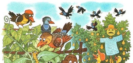
The fauna is extremely rich, especially the world of birds - doves, marabou, parrots, owls, ostriches, weavers, toucans, hoopoes, herons and hawks. Large mammals (buffaloes, giraffes, wild boars, rhinos and elephants) live mainly in national parks. Antelopes, hippos, viverras, wolves, hyenas, wild goats, zebras, crocodiles, lemurs, leopards, lions, monkeys and jackals are common. Lots of reptiles (cobras, pythons, horned snakes, turtles and lizards) and insects. Coastal waters are rich in fish (swordfish, sawfish, sardines, tuna), shrimps and lobsters.
Economy
Mozambique is an agricultural country. One of the poorest countries in the world, however, is seen as developing country with a dynamic economy.
Agriculture. The share of agriculture in GDP is 22% (2001). The increase in agricultural production averages 6.2% (in 1998 - 8%). One of the few African countries, in which there is no "land hunger": fertile land is 36 million hectares, but only 5.4 million hectares (15%) are cultivated. The economic development of new lands is complicated by the danger of numerous mines left after the civil war. Irrigated lands occupy an area of 120 thousand hectares. The share of agricultural products in exports is approx. 25%. The main food crops are corn (70% of all cereals) and cassava (cassava). Oranges, peanuts, bananas, gourds, legumes, potatoes, coconuts, sesame, mangoes, cashews and cola nuts, papaya, sunflowers, rice, sugarcane, sisal, sorghum, tobacco, cotton and tea are grown. Animal husbandry (cattle, goats, pigs and sheep) is concentrated in the southern provinces, where tsetse is not common. Most farms raise chickens. Fisheries have developed rapidly since the 1990s, mainly shrimp, sharks, crayfish and lobsters. Growth in fisheries in con. 1990s was up to 30.5% annually. Experts believe that up to 500,000 tons of fish and 14,000 tons of shrimp can be caught annually in the Mozambique maritime economic zone. In 1999, Japan allocated $3.4 million to modernize the fishing port in Maputo, including the installation of large cold stores. The development of forestry is greatly damaged by predatory felling and smuggling of valuable tree species abroad.
Attractions
Mozambique is one of the most ancient states in the world. People have lived here for over 2 million years, the first fossils Homo sapiens first discovered in this area. Various peoples, many of whom have now disappeared from the face of the Earth, swept through this earth in waves of migration for at least 100,000 years. Around 2,000 years ago, the Bantu peoples began migrating to the area, bringing iron tools and weapons, and formed the basis of the country's modern population. Thriving trade in gold and ivory raised the civilization of Mozambique to one of the most high levels in Africa, and until now the bowels of the country are fraught with many mysteries and secrets of past eras. Tourists are attracted to the country mainly by beautiful sandy beaches. The beautiful shores of Tofu, Moma, Langoshe, Lourio and Cape Barra were legendary places until recently and are rapidly regaining their former fame. The Tofu area is more accessible and more developed, with a hotel and a well-organized recreational structure relatively lightly affected. Barra is somewhat more inaccessible, but quieter, and with somewhat better conditions: clear dunes with constant surf on one side and mangrove forests and palm groves on the other side of the cape, where flocks of almost tame parrots and monkeys are quite common. Maputo, the capital of the country, grew on the site of a Portuguese fort founded in 1781, from which ramparts, old guns and a grassy courtyard have been preserved. There are almost no ancient buildings in the city. Maputo was previously known as a very beautiful city and was rated by travelers on a par with Cape Town and Rio de Janeiro, but after almost 20 years of war and deprivation, the capital is very dilapidated, with crumbling buildings and dirty streets. However, it is still very interesting place, with a very lively atmosphere and friendly residents, slowly but surely restoring its former charm. Among the sights of the city are the Museum of Natural History and the railway station, designed and built at the beginning of the 20th century. the same Eiffel who created the famous tower in Paris. The recently refurbished station looks more like a palace, topped by a giant copper dome with polished wood and marble decorations. Also of interest are the Botanical Gardens, the National Art Museum, which has a fine collection of the best contemporary artists of Mozambique and the lively Municipal Market, which sells a variety of fruits, vegetables, spices and traditional wickerwork of local artisans. Beira 880 km. north of Maputo - the second largest city in Mozambique, is the main port and terminus of the trans-African railway. Its compact central area and old Mediterranean-style buildings give the city a special charm. The heart of the city is the Prasa (main square), which is surrounded by shops, markets and offices. Cathedral , lying to the southeast of the center, looks somewhat unkempt, but has definitely retained the former grandeur of its inner stop. The bustling market at Chunga Moyo ("brave heart") is full of imported goods and contraband. "Beautiful sands" (and quite rightly) is called the coast near Praia de Macouti. The entire coast of this area is rich in various cases of finds of shipwrecks of past centuries, especially many of them are thrown ashore by the surf near the "red" and "white" lighthouses at the northern end of the beach. Pemba - a coastal town at the throat of a large bay in the north of the country - can be proud of its interesting buildings, especially in Byxa - the old town, and the lively atmosphere of its streets. Most visitors come here for the luxurious beaches, especially Wimby (or Wimbe) Beach and coral reefs, located so close to the coast that they can be easily reached by swimming. Wimby is 5 km away. east of the city. A rapidly recovering tourism industry is already transforming the place into a fashionable resort with bars, restaurants, water entertainment centers and well-equipped areas for diving, snorkeling, rowing, fishing, surfing and more. On the road between the city and the beach, there is a Makonde craft workshop that makes beautiful wooden figurines for sale at very low prices. Of interest is the Cathedral of 1563 in the town of Tete, 150 km. to the southeast down the Zambezi River, however, to visit it, you must have permission from the authorities, which is due to the turbulent situation in the area. 500 km. northwest of the coast, the Zambezi River is dammed by the huge Cahora Basso Dam, built in the 1970s, one of the largest civil engineering projects in Africa. Lying in stunning scenery at the mouth of a magnificent gorge, the dam has created the grand lake of Lago de Cahora Bassa 270 km. long, stretching upstream to the confluence of the Zambezi and Luangwa rivers on the border with Zambia. Ile de Mozambique (commonly called simply "Ile") is a small piece of land located 3 km. from the mainland and connected to it by a bridge, was formerly the capital of the East African colony of Portugal. Il is famous now because of the many mosques and churches and its Hindu temple. Most of the historical sites are located on the northern half of the island, which has been declared a UNESCO World Heritage Site. Attraction number one - the Palace and Chapel of Sao Paulo - the residence and place of residence of the former governor of the country, dating back to the 18th century. This building is a large area paved with great taste with stones mined here, on the western tip of the island. Today it is a museum that contains rare furniture and jewelry from Portugal, Arabia, India and China, in remarkably good shape for such a turbulent history. Nearby is the Museum of Sacred Art containing religious decorations, paintings and sculpture. At the northern tip of the island are the medieval fort of San Sebastian, also in remarkably good condition, and the Chapel of Nossa Señora de Baluarte, the oldest building in southern hemisphere. Mozambique has a rich artistic tradition that may seem incredible as it continues to thrive after decades of colonialism and civil war. Today, Mozambique has one of the most distinctive and interesting forms of folk art in Africa. Makonde sculpture is recognized as one of the most complex and sophisticated art forms in Africa. The traditions of fresco painting are also strong, the first samples of which were found during excavations of settlements more than 2 thousand years old. The largest and most famous of the modern frescoes is located near the capital's airport, has a length of 95 m, and reflects the events of the Revolution period. Traditional music is very popular both in Mozambique and beyond, many researchers, not without reason, consider it one of the origins of "reggae" and new age. The "wind instruments" ("lupembe") of the Makonde people in the north of the country are unique. In the south, musicians traditionally use the "marimba", a type of xylophone that has spread from these places throughout southern Africa. Mozambican marimba orchestras are widely known all over the world, gathering full houses in the best concert halls of the planet. The "marrabenta" they play is the most typical Mozambican music, with a light style and traditional rural rhythms. One of the most beautiful places on the continent is the Bazaruto Archipelago Marine National Park, 10 km away. from the coast, with blue waters, sandy shores, thickets of palm trees, ancient coral reefs, plus a myriad of tropical fish that inhabit these waters. Scuba diving and excellent fishing are also possible here. The whole area between the mainland and the 150 islands is now protected as a world class nature reserve. If you're staying in one of the dozens of luxury cabins on the islands, it's possible to rent a speedboat for a mini-cruise around the archipelago. Also quite interesting National parks countries - Gorongosa, Banyin, Zinave, etc., are rapidly recovering and possessing a full range of natural attractions and unique wildlife.
Mozambique is located in southeast Africa, on the coast of the Mozambique Channel of the Indian Ocean. Its territory (802 thousand sq. km) stretches from north to south along the ocean coast for almost 3000 km. It is divided into two large regions by a part of the territory of Malawi deeply wedged into the country.
It borders Tanzania to the north and Tanzania to the south and southwest. South Africa and Swaziland, in the west - with Zambia, Zimbabwe and Malawi. In the east it is washed by the Mozambique Channel. Two-fifths of the country's territory is occupied by coastal plains. There are several plateaus in the center of the country, reaching the highest point of 2436 m (Mount Binga) near the western border. The Namuli mountain range in the north of the country rises to 2419 m. In the northeast lies the Angonia plateau.
In the northern - wider region lies the Mozambique Plateau, descending in steps to the east to a narrow coastal lowland (up to 30 km wide). To the south, the lowland expands to 400 km, occupying a total of 44% of the entire area of the country. The northern shores are rocky and steep with coral reefs and sandy islands, the southern shores are low, partially swampy. Beautiful sea bays in the past were a haven for pirates, and then the centers of the slave trade. Along the border with South Africa, the volcanic mountains of Lebombo rise; to the north (near the border with Zimbabwe) they pass into the Inyanga ledge (from highest point countries - the city of Binga, 2436 m) and the Gorongoza mountain range.
Relief, soils and minerals of Mozambique
The relief of the territory is quite uniform, it is a flat plateau, inclined from west to east. Only in the northwest rise small mountain spurs. The highest peak is Mount Binga (2436 m). In the east, the plateau merges into a horizontal coastal plain stretching from the border with Tanzania to the border with South Africa, it accounts for 45% of the entire territory.
From west to east, the country is cut by 25 fairly full-flowing rivers flowing into the Indian Ocean, the largest of which is the Zambezi. Of the 820 km of its channel on the territory of M., 460 km are navigable. On the border with Malawi is Lake Nyasa, and on the border with Zimbabwe is the Kabora Bassa reservoir.
The soils are very diverse: sandy, red-brown laterized and alferritic, alluvial, etc.
The subsoil is poorly explored, the discovered minerals testify to their wealth. Known deposits of coal (its reserves are estimated at 10 billion tons), iron ore (500 million tons), tantalite, ilmenite, graphite, bauxite, manganese, platinum, gold, nickel, uranium, titanium, zirconium. In 1999, geologists discovered another titanium deposit, perhaps the largest in the world (100 million tons of metal). Two natural gas fields have been discovered (reserves of at least 60 bcm).
Water resources of Mozambique
Numerous rivers of the country originate in the mountains in the west and flow into the Mozambique Channel. main river is Zambezi, and the largest are Ruvuma, Savi and Limpopo. On the territory of the country lies also part of Lake Nyasa (Lake Malawi).
Ruvuma - river East Africa, most of the river forms the border between Tanzania and Mozambique. It is formed by the confluence of two almost equal tributaries, the longer of them, the Luzhenda, flows from the northwest, the other, also named Rovuma, from the west. Its source is located on a hilly plateau at an altitude of about 1000 m, strictly east of Lake Nyasa. Other significant tributaries, besides the Luzhenda, are the Msinzhe and the Luchulingo, flowing through wide valleys from south to north. In the lower reaches, the river expands noticeably, forming islands covered with forests, many of which are inhabited. During the dry season, the river can be forded in many places. The width of the mouth is about 1600 m. The Rovuma in the lower reaches is mostly shallow, although its width is about 800 m. There it flows through swampy plains, on the sides of which rise steep slopes of the plateau, from which several insignificant tributaries flow. The length of the river is about 1600 km.
Nyasa, Malawi, a lake in Africa, in Mozambique, Tanzania and Malawi. It is located in a discharge depression at an altitude of 472 m. The area is 30.8 thousand km2. Depth up to 706 m (in the northern part of the reservoir, where its bottom lies significantly below sea level). The shores are steep and rocky, high, especially in the north and northeast. The southern part of the basin lies in a wide depression, the banks are framed by a narrow strip of the coastal plain. The average annual inflow of water into the lake (river runoff plus precipitation) is about 72 km2, evaporation is about 66 km3. Stock on the river. Shire, flowing into the river. Zambezi. Seasonal level fluctuations reach 1 m. Wider. The lake is rich in fish (about 230 species), in particular species of tilapis, crocodiles, hippos, and many waterfowl. Strong storms and surfs near steep coasts are typical, making navigation difficult (passengers are transported only during the day). Ports: Chipoka, Nkota-Kota, Karonga, Bandawa, Monkey Bay (Malawi), Mwaya, Mbamba Bay (Tanzania), Kobwe, Metangula (Mozambique). Discovered in 1616 by the Portuguese G. Bucarru.
Climate of Mozambique
The climate of the north is close to equatorial; in the south - tropical trade winds. There are only two seasons: wet summer and dry winter. Temperatures in most areas are very high (+25 - +28C), and the maximum marks occur during the rainy season. On the plains, there is almost no difference between summer and winter temperatures, although the plateau is somewhat cooler. The amount of precipitation decreases from north to south from 1500 to 500 mm per year. On the coast and in the mountains, tropical downpours occur, sometimes causing catastrophic floods, and in the south, the main disaster is drought (especially strong were observed in 1974, 1982 and 1983). There are many rivers, the largest of them - Zambezi, Limpopo, Savi and Ruvuma are navigable only in the lowlands. All rivers flow from west to east and empty into the Indian Ocean. In the rainy season, floods take on a threatening character in some years, while in the dry season, many rivers become shallow, turning into chains of lakes, or completely dry up. The inconstancy of the flow, shallows, rapids and waterfalls in the mountainous part make navigation difficult. Mozambique owns the eastern steep shores of a giant freshwater lake. Nyasa, lying at the junction of Mozambique, Malawi and Tanzania.
Flora and fauna of Mozambique
Approximately 2/3 of the country's territory is occupied either by tall grass savannah with isolated groups of acacias and baobabs (park savannah), or deciduous light forest called miombo. Savannah dominates the plateaus and uplands, as well as in the dry central regions in the south of the country. Miombo is found in many places, but especially on the plateau north of the river. Zambezi. The high areas are occupied by mountain forests with Mlangian cedar and podocarpu. In southern Mozambique, broad-leaved mopani, acacia and other low-growing trees form a forest savanna ("mopaniveld") that sheds its leaves during the dry season. Dense tropical forests with valuable species of trees (black, iron, pink), palm trees and lianas stand like a green wall along the banks of the rivers; The coast is occupied by mangroves. In general, forests occupy about 1/5 of the territory, but they are becoming less and less due to clearing for agriculture or for fuel. Arable land occupies about 4% of the country's area, pastures - 56%. The animal world is extremely rich and diverse, especially the world of reptiles and birds, and Russian swallows winter in the south of the country.
At the same time, large mammals and predators are fully represented only in natural parks: elephants, African (Kaffir) buffaloes (the largest herds here), white rhinos, antelopes, zebras, lions, leopards, hyenas, jackals, hippos, crocodiles.
Population of Mozambique
The population of Mozambique in 2007 was 20,366,795 people. In 2006, the natural population growth was 1.8%, having decreased by 0.8% compared to 1996. Infant mortality has decreased since 1996 from 125 to 109 per 1,000 babies. The birth rate decreased from 45 to 30, while the death rate increased from 18.97 to 20.51 per 1,000 people, respectively. The number of people over 65 increased from 2.8% to 3%, children - decreased from 46% to 44.7%, respectively. According to forecasts, by 2050 the number of people over 65 in the country will grow to 7.8%.
98% of the population of Mozambique are peoples language family Bantu. The most numerous people are the Makua people (more than 50%) living in the north of the country. In the south, on the border with South Africa, the Tsonga (about 25%) are settled. Malawi (about 13%) and Yao (more than 3%) live along Lake Nyasa, in the center - Shona (about 6%), in the northeast - Makonde. There are also Swahili, Zulu, which are much smaller in number.
The country is inhabited by immigrants from Asia (Indians make up 0.08% of the population), as well as mulattoes. The number of people of European nationality has greatly decreased (from 2% to 0.06%) after Mozambique gained independence. In total, 16 different ethnic groups are represented here, the largest of which is the Makua people living in northern Mozambique. Other northern peoples include the Makonde, known for their wood carvings and lupembe (wind instruments). In the central part of Mozambique live the Sen, in the south of the Shangaan. Europeans and Portuguese make up only less than 1% of the population.
The majority of the population of Mozambique adhere to traditional African beliefs, while the remaining minority professes Christianity (especially urban residents) or Islam (mainly residents of the northern region of the country). These three main religious groups are in constant interaction with each other, so it is quite common to see character traits traditional beliefs in Mozambican Christianity or Islam and vice versa.
The official language in Mozambique is Portuguese, but it is spoken by only about a quarter of the population, those who have school education. The Portuguese language is used in educational institutions, in business and the economy, the government, which in turn causes considerable inconvenience to those residents of the country who do not speak this language at all. In addition to the Portuguese language, about 60 languages are used by the local population. various languages and dialects, to a greater extent having Bantu roots. It is quite primitive to classify the use of a particular language depending on the region of the country. So, for example, 40% of the population living in the north of the Zambezi River use a rare Macua Longwe dialect. The Tsonga language is predominant south of Limpopo, while the Tonga and Shona languages can be heard in the central part of the country. Some residents communicate in the Kiswahili language, which is a simplified version of the Bantu language with Arabic features.
Source - http://www.igras.ru/
http://www.travel-box.ru/
Mozambique a country in southeastern Africa. In the north it borders with Tanzania, in the south and southwest - with South Africa and Swaziland, in the west - with Zambia, Zimbabwe and Malawi. In the east it is washed by the Mozambique Channel.
The name of the country comes from the name of Sultan Musa Ben Mbika.
Capital
Area
Population
19400 thousand people
Administrative division
The state is divided into 11 provinces.
Form of government
Republic.
head of state
President elected for a term of 5 years.
supreme legislative body
Assembly of the Republic.
Supreme executive body
Government.
Big cities
Beira, Nampula.
Official language
Portuguese.
Religion
60% pagans, 30% Christians, 10% Muslims.
Ethnic composition
47% - Makua Lomwe, 23% - Tsonga.
Currency
Climate
The climate in Mozambique is tropical. In summer months, the average monthly temperature is about + 27 °С, and in winter - + 20 °С. The rainy season lasts from April to October, with precipitation of 1300-1500 mm per year in the north, 500-1000 mm in the south.
Flora
Forests cover about 20% of the territory of the state. In the south - tropical forests with valuable tree species (ebony, iron, pink, etc.). In the river valleys, wet gallery forests intertwined with lianas have been preserved, along the coast - mangrove forests.
Fauna
The fauna of Mozambique is rich - elephant, antelope, zebra, rhinoceros, lion, leopard, jackal, hyena, bull, crocodile, monkeys stand out, among insects - termites, mosquitoes. A large number of snakes and birds.
Rivers and lakes
The largest rivers are the Zambezi, Limpopo, Savi, Ruvuma. Lake Nyasa is partially located on the territory of the state.
Attractions. In Maputo - the Museum of Natural History, in Tete - the Catholic Cathedral of 1563. National parks of the country are widely known.
Useful information for tourists
The flourishing trade in gold and ivory raised the civilization of Mozambique to one of the highest levels in Africa, and to this day the bowels of the country are fraught with many mysteries and mysteries of past eras. Tourists are attracted to the country mainly by beautiful sandy beaches. The beautiful shores of Tofu, Moma, Langoshe, Lurio and Cape Barra are legendary holiday destinations.
Geographic location of Mozambique. Mozambique stretches for 2500 km along the southeast coast of the Mozambique Channel of the Indian Ocean in the southeast of the African continent. In the north it borders with Tanzania, in the south and southwest - with South Africa and Swaziland, in the west - with Zambia, Zimbabwe and Malawi. The relief of the country is very diverse and picturesque.
Almost half of the country is occupied by the Mozambique lowland, reaching a width of 400 km in the south, and narrowing to several tens of kilometers in the north. Slightly hilly, overgrown with tropical forests, the plain rises gently to the west to 350-400 m above sea level. In the north there is the Nyasa plateau (average heights are 500-1000 m, some peaks rise up to 2000 m), which breaks off to the lake of the same name, and in the west and north-west there are the crystalline plateaus of Mozambique, Angoni and Motabeli with the highest point of the country - Mount Binga (2436 m). In the southwest, near the border with South Africa, the volcanic mountains of Lebombo rise. A part of Lake Nyasa (Lake Malawi) also lies on the territory of the country.
The total area is 801.6 thousand square meters. km.
The capital is Maputo.
MOZAMBIQUE Time
Behind Moscow for 2 hours.
Visa to Mozambique
Russian citizens need a visa to visit Mozambique.
According to the 1997 census, Mozambicans identify themselves with the following denominations:
Non-religious (perhaps many in this group retain traditional beliefs) - 24.25%;
Catholics - 24.2%;
Muslims - 17.8%;
Non-Catholic Christians (mostly Protestants) - 11.45%;
Syncretic cults (a mixture of different religions, for example, combining elements of Christianity and traditional African beliefs) - 18.7%;
Others - 3.6%.
LANGUAGE: In addition to Portuguese, English is also used (especially in the capital). The most commonly spoken local languages are Imakua (Makua), Chinyangja (Malawi), Chishona (Shona) and Shangaan (Tsonga)
Climate. 
The climate in the north is subequatorial monsoon, in the south - tropical trade winds, there are almost no temperature differences between seasons (average temperatures are 25-28C). In the southern part of the country, the average temperatures are slightly lower (about 20C), and the amount of precipitation is also less: 750-1,000 mm falls here annually, while in the northern part of the country and on the windward slopes of the plateaus - up to 1,500 mm.
Mozambique has significant potential for the development of the tourism business: the sandy beaches of the Indian Ocean, high average annual air and water temperatures, the picturesque island of Nyasa, a variety of animals and flora, extensive hunting grounds and conditions for deep-sea hunting for exotic fish (marlin, etc.). Best time for travel - July-September
Vegetable world.
The northern part of Mozambique is characterized by sparse forests, in the center of the country there are light tropical forests, the species composition of which is dominated by brachistegia, the Mlangian cedar. To the south of the Zambezi River, tall-grass savannahs with groups of acacias and baobabs appear.
Animal world. 
The fauna of Mozambique is rich and varied: herds of elephants, hippos, ungulates, an abundance of lions and crocodiles live here; there are rare white rhinoceros, kaffir buffalo. Lots of birds: toucans and parrots, marabou and hawks. The coastal waters are inhabited by sawfish, swordfish, many shrimps and lobsters.
Mozambique is one of the most ancient states in the world.
Tourists are attracted to the country mainly by beautiful sandy beaches. The beautiful shores of Tofu, Moma, Langoshe, Lourio and Cape Barra were legendary places until recently and are rapidly regaining their former fame.
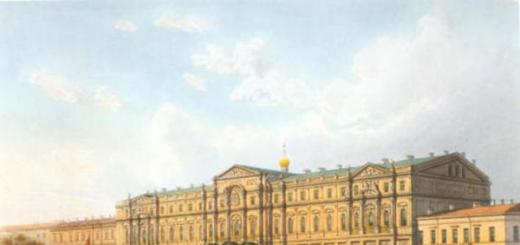
Maputo, the capital of the country, grew on the site of a Portuguese fort founded in 1781, from which ramparts, old guns and a grassy courtyard have been preserved. There are almost no ancient buildings in the city.
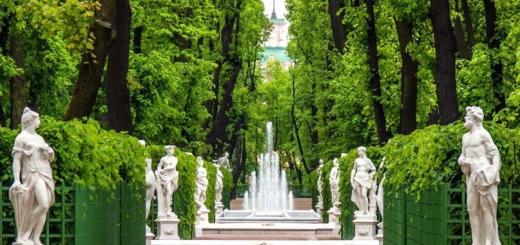
Also of interest are the Botanical Gardens, the National Art Museum, which has a fine collection of the best contemporary artists of Mozambique and the lively Municipal Market, which sells a variety of fruits, vegetables, spices and traditional wickerwork of local artisans.
Beira 880 km. north of Maputo - the second largest city in Mozambique, is the main port and terminus of the trans-African railway. Its compact central area and old Mediterranean-style buildings give the city a special charm. The heart of the city is the Prasa (main square), which is surrounded by shops, markets and offices.
National parks and reserves in Mozambique

One of the most beautiful places on the continent is the Bazaruto Archipelago Marine National Park, 10 km away. from the coast, with blue waters, sandy shores, thickets of palm trees, ancient coral reefs, plus a myriad of tropical fish that inhabit these waters. Scuba diving and excellent fishing are also possible here. The whole area between the mainland and the 150 islands is now protected as a world class nature reserve. If you're staying in one of the dozens of luxury cabins on the islands, it's possible to rent a speedboat for a mini-cruise around the archipelago.
Also quite interesting are the national parks of the country - Gorongosa, Banyin, Zinave and others, which have a whole range of natural attractions and unique wildlife.
Shops and souvenirs.
In local markets, you can buy all kinds of crafts: wicker baskets and mats decorated with beads, gourd (calabash) vessels, carved wood products, smoking pipes, masks and clay vessels.
In Mozambique, everything that does not have a price tag is subject to bargaining.
Communications in MOZAMBIQUE
Internet is missing.
Mobile communications are not supported.
Capital - Maputo
Geographical position and relief
The state is located in the southeastern part of Africa. In the east it is washed by the waters of the Indian Ocean. It borders with countries such as: Tanzania, Zambia and Malawi in the north, Zimbabwe in the west, South Africa and Swaziland in the southwest. The relief of the area is heterogeneous, in the north and western border hills and mountains prevail, the central, southern and coastal parts of the country are low-lying with numerous swamps.
Economy
Mozambique is an agrarian power with a high level of poverty. More than 80% of employees are engaged in agriculture. The main crops grown are cashews, sugar cane, coconut palm, cotton, peanuts, sorghum, etc. Logging and fishing are carried out. Industry is underdeveloped. The country has enterprises for the processing of agricultural raw materials, the production of soap, drinks, cigarettes, etc. The mining industry produces such Natural resources as: copper, coal, bauxite, iron and tantalum ores. The economy of the state depends on international assistance.
Climate
The northern part of the state is located in the subequatorial climate zone, the southern part is tropical humid. There are two seasons: dry and wet (November-April). Average temperatures in most of the country in January are +30 °С, in July - + 22 °С.
Population
The population is 28,830 thousand people. By ethnic composition many peoples and nationalities are represented: Makua, Malawi, Shona, Tsonga, Yao and others.