Smolensk Principality, an ancient Russian principality that occupied territories along the upper reaches of the Dnieper. From cities in the Smolensk Principality, in addition to Smolensk , Toropets, Orsha, and later Mstislavl and Mozhaisk were of great importance. The political isolation of Smolensk began in the 1030s. The Smolensk principality became independent under Prince. Rostislav Mstislavich (1127 - 59), grandson Vladimir Monomakh. Under him, it expanded significantly and reached its greatest prosperity and power. In 1136, a diocese was established in the Smolensk principality, which later received lands and privileges. Under the successors of Roman Rostislavich (1160 - 80), the fragmentation of the Smolensk principality into appanages and a decrease in its influence on all-Russian affairs began. At the same time, the Principality of Smolensk was attacked by German crusaders and Lithuanian princes. In the 2nd half. XIII century Mozhaisk and Vyazemsky appanages were separated from the Smolensk principality. This weakened the Smolensk principality in the fight against the Lithuanian princes. Book Svyatoslav Ivanovich (1358 - 86) led an energetic struggle with Lithuania for the independence of the Smolensk principality, but was defeated and died in the battle on the river. Vehre. The Principality of Smolensk was captured by the Lithuanian prince. Vitovt. In 1401, an uprising against the power of the Lithuanians took place in the Principality of Smolensk. The Smolensk people put Yuri Svyatoslavich on the Smolensk table. But in 1404 Smolensk was again taken by Vitovt. The Smolensk principality lost its political independence. It became part of the Polish-Lithuanian state. The Smolensk land was returned to Russia in 1514, captured by Poland in 1618 and returned again in 1667.
G. Gorelov
Ruling princes
The so-called Rostislavich dynasty was established on the table in the Smolensk principality, the founder of which was Rostislav Mstislavich (1128-1160), the son of the eldest son of Vladimir Monomakh, Mstislav the Great.
Vyacheslav Yaroslavich 1054-1057
Igor Yaroslavich 1057-1060
Izyaslav Yaroslavich division of land 1060-1073
Svyatoslav Yaroslavich division of land 1060-1073
Vsevolod Yaroslavich division of land 1060-1073
Vladimir Vsevolodovich Monomakh 1073-1095
Davyd Svyatoslavich 1095-1097
Svyatoslav Vladimirovich 1097-1113
Vyacheslav Vladimirovich 1113-1116
Board of mayors of Vladimir Monomakh... 1116-1128
Rostislav Mstislavich 1128-1160
Roman Rostislavich 1160-1173
Yaropolk Romanovich 1173-1174
Roman Rostislavich (secondary) 1174-1175
Mstislav Rostislavich the Brave 1175-1177
Roman Rostislavich (for the third time) 1177-1180
Davyd Rostislavich 1180-1197
Mstislav-Boris Romanovich Old 1197-1214
Vladimir-Dmitry Rurikovich 1214-1219
Mstislav-Fyodor Davydovich 1219-1230
Svyatoslav Mstislavich-Borisovich 1232-1238
Vsevolod Mstislavich-Borisovich 1239-1249
Gleb Rostislavich 1249- 1278
Mikhail Rostislavich 1278-1279
Fyodor Rostislavich Black 1280-1297
Alexander Glebovich 1297-1313
Ivan Alexandrovich 1313-1358
Svyatoslav Ivanovich 1358-1386
Yuri Svyatoslavich 1386-1391
Gleb Svyatoslavich 1392-1395
1395-1401 - Lithuanian occupation.
Yuri Svyatoslavich (secondary) 1401-1405
Book materials used: Sychev N.V. Book of Dynasties. M., 2008. p. 106-131.
The eastern part of the Smolensk land reached Mozhaisk and, judging by the testimony of contemporaries, also in the 15th-16th centuries. was densely forested (and there are also almost no mounds here). The path from Smolensk to Moscow was all through forest. 130 versts between Vyazma and Mozhaisk, according to A. Meyerberg (1661), stretched a continuous forest, “the desert of which is protected by one village of Tsarevo-Zaymishche.” “The path from Smolensk to Moscow,” echoes Adolf Lisek (1675), “is as dangerous from bears as it is boring due to continuous forests. The only road between these cities runs along a strip of cleared forest about 30 feet wide with a log deck running through the swamps.”

There were also dense forests in the southeastern reaches of the Smolensk land. In 1370, driving away Olgerd, “the mozhaichi were driven away and the Smolnyans were beaten in the forest on Bolognese, and they were full of waste.” The village of Belonovtsy on the river. Desnoga, 16.5 versts from Yelnya, indicates to us that this forest began somewhere to the southeast of this city. Most likely, in the upper reaches of the Bolva, where there are few mound groups, there was a Bleve point.
There are still many forests in the southern Smolensk region. In Roslavl district. back at the beginning of the 20th century. they occupied 40.5%, and in ancient times there were significantly more of them. The forest crossed at the headwaters of the river. Bolva to the so-called Bryn Forest, which stretched from Kaluga to Bryansk, according to the Book of the Big Drawing. In addition to the border Smolensk forests, which went deep into the Earth, there were forests that did not extend to the borders. Smolensk, according to S. Herberstein, “is surrounded by vast forests from which various furs are extracted.” A. Lizek also writes about the dense forests between the border of Lithuania and Smolensk: having traveled 8 miles from the border of Lithuania, he had to spend the night among the dense forest, lighting fires from the bears. Near Smolensk, his embassy was waiting for an invitation to the city, also in a large forest. Finding himself in a large flood, S. Herberstein was forced to transfer to a boat driven by a monk and sail from Smolensk to Vyazma among the forests, etc.
It is important for us that the spaces that were deserted, according to the reviews of travelers of the 16th-17th centuries, do not have burial mounds. This means that the picture of population for the pre-Mongol period based on the mounds is quite objective.
Clusters of settlements in the ancient Smolensk region. Let us turn to the study of territories taken by man from the forest. In the Smolensk land there are three largest concentrations of settlements of the ancient Slavs: in the area between the Sozh - Dnieper - Kaspli rivers, in the upper reaches of the Western Dvina (near the Toropets and Zhizhetskoye lakes), in the Dnieper - Desna interfluve.

About the population of the Western Dvina - Toropa V.V. Sedov noted that these were areas in which earlier (VII-IX centuries) the population was buried in long mounds, which gave him the right to talk about the genetic continuity of these places of the population of the X-XII centuries. from earlier. Abundance of burial mounds in Toropetsk district. already noted by M.I. Semevsky, there are a large number of them on the river. Velese (formerly Moninsky parish) was also indicated in the literature. Works by Ya.V. Stankevich found out that the Toropets cluster of settlements arose at the beginning of the second half of the 1st millennium AD. e. At the same time, population clusters began to appear near the lake. Zhizhetskoye, to the northeast between the lake. Luchansky and Okhvat, the history of the population of these areas is undoubtedly close to the Toropets population. A different picture awaits us further south: between the Velizh current of the Western Dvina and the Dnieper; here on the river Gobze density is very low; judging by the mounds, ancient villages stretched in narrow strips across the watershed. The western one went through Kasplya, the middle one - from Smolensk north to Verzhavsk, the eastern one - from the mouth of the Vopi, also to Verzhavsk (Fig. 2). The volost of Verzhavlyane the Great, which we read about in the Charter of Rostislav in 1136 as the most solvent, consisting of 9 churchyards, should be seen in small clusters of settlements scattered along the rivers around Verzhavsk; a comparatively larger cluster on the left bank of the Western Dvina, obviously, was considered to be two graveyards, and the most remote Verzhavsk churchyard northeast of Verzhavsk should be seen in the village of Devyataya, where there are mounds and a settlement of pre-Mongol times (Fig. 4). In the northern part of the Smolensk land there were also clusters of settlements, albeit of a smaller size: on the river. Pyryshne at the very edge of the Okovsky forest, where near the village. Okovets there are mounds and a fortified settlement of the 9th-10th centuries, as well as on the upper Mezha with its tributaries.
The central cluster of settlements in the Sozh-Dnieper and Kaspli region most spread to the left bank of the Dnieper (Fig. 4). E.A. Schmidt divided this population into three chronological groups: at the first stage (VII-VIII centuries) there was a small population here, forests abounded, one might think. In the second (IX-X centuries) to the west of modern Smolensk (which did not yet exist at that time), on both sides of the Dnieper, a colossal Krivichi tribal center grew up, which, as I tried to show, was the ancient Smolensk, as they rightly propose to consider, similar to the Scandinavian Viks - Birke and others. At the third stage (XI-XIII centuries) this city died out, since feudal Smolensk was moved to its modern location. However, the territory of this cluster on the left bank was intensively populated. Residents cut into forests, expanding crops. Archaeological monuments of this time, showed E.A. Schmidt, varied - they reflected villages, churchyards, feudal estates, etc. The remains of settlements of the same cluster in its eastern part were studied by V.V. Sedov and were also divided into three groups according to time, however, his late stage also included the developed Middle Ages. Close to the central group of settlements there is a cluster of them in the area of that part of the upper Dnieper, where the path to the portage to the Ugra with the toponyms Volochek (Dnieper side) and Luchin-Gorodok (bank of the Ugra) departed. The spontaneous enrichment of the population of the Volok of the 11th-12th centuries, which traded in transportation along the watershed, was soon (mid-second half of the 12th century) stopped by the feudal center of Dorogobuzh, which, apparently, moved into the zone of the princely domain. To the north of the Dorogobuzh population cluster we will mention the clusters of ancient inhabitants of the 10th-11th centuries. and later on the river. Vyazma, the upper reaches of which were close to the upper reaches of the Vazuza, and other tributaries of the Ugra (Fig. 2; 4). These accumulations also led to the formation at the beginning of the 13th century. feudal center Vyazma (first mention - 1239).
Rice. 5. Coin treasures and individual finds of coins in the Smolensk land. 1. Treasures. 2. Single finds of coins. 3. Clusters of settlements (by mounds). 4. Borders of Smolensk land. 5. Portages, according to toponyms. 1 - “Gnezdovsky Smolensk”, 2 - Ilovka, 3 - Kislaya, 4 - Slobodka (Przhevalsk), 5 - Saki, 6 - Glazunovo, 7 - Toropets, >8 - Kurovo, 9 - Paltsevo, 10 - Zhabachev, 11 - Gultse , 12 - Gorki, 13 - Semenov-Gorodok, 14 - Rzhev, 15 - Dunaevo, 16 - Panovo, 17 - Kharlapovo, 18 - Dorogobuzh, 19 - Yartsevo, 20 - Zhigulino, 21 - Mutyshkino, 21 - Borshchevshchina, 23 - Sobolevo , 24 - Zastenok, 25 - Staroselye, 26 - Old Dedin, 27 - Gorki, 28 - Popovka, 29 - Peschanka, 30 - Zimnitsa
We see scattered Smolensk villages (sparse clusters) to the east and again in the areas of convergence of the right tributaries of the Vazuza and the left Ugra, among them the village of Panovo stands out, where during excavations foreign things, dirhems, etc. were discovered (see section “Trade” "), as well as p. Iskona, even further east, near the border of Vyatichi and Krivichi, is a volost known from the Charter of Rostislav of 1136 - Iskona, which paid tribute directly to Smolensk and, therefore, is quite independent.
The third large cluster of settlements is located in the southern Smolensk region, inhabited by the Radimichi. A few cremation mounds (9th-10th centuries) show that at that time only small settlements of several houses were scattered here. Obviously, the bulk of the inhabitants of these places, judging by the inhumation mounds, arose in the 11th-12th centuries. But this process was internal, because there are no foreign materials in the mounds that indicate migration. The Radimichi intensively populated the upper reaches of Stometi, Ostra, middle Sozh, and the upper reaches of Besedi. There are fewer mounds near the southern border of the Smolensk lands; forests abounded here, separating the northern Radimichi from the rest, which were the border between the principalities. How can we explain the existence of such a border within the large Radimichi tribe? Based on the funeral rite, G.F. Solovyova outlined 8 small tribes of Radimichi. In the zone of the Smolensk Radimichi, she managed to isolate only one such tribe (group eight). The remaining radimic territory, where it was not possible to detect signs of small tribes, is twice as large in area and number of monuments as the neighboring small tribes. It is possible that two small tribes of Radimichi lived here, separated together with the third (the eighth group of Solovyova) from the rest by forests, which Rostislav of Smolensk took advantage of, annexing them to his land (1127?, see below). If the assumption about these two small tribes is confirmed and the Radimichi had, therefore, 10 such tribes, then this will confirm the interesting hypothesis about the decimal division of the ancient Russian large tribes put forward by B.A. Rybakov.
PRINCIPALITY OF SMOLENSK , an ancient Russian principality located along the upper reaches of the Dnieper. The capital is Smolensk. It was formed on the waterway “from the Varangians to the Greeks.” Separated from the Old Russian state in the 30s. 12th century In the 2nd half of the 14th century. fought with the Grand Duchy of Lithuania, to which it was annexed in 1404.
Source: Encyclopedia "Fatherland"
An ancient Russian principality that occupied territories along the upper reaches of the Dnieper. Of the cities in the Smolensk principality, in addition to Smolensk, Toropets, Orsha, and later Mstislavl and Mozhaisk were of great importance. The political isolation of Smolensk began in the 1030s. The Smolensk principality became independent under Prince. Rostislav Mstislavich (1127 - 59), grandson of Vladimir Monomakh. Under him, it expanded significantly and reached its greatest prosperity and power. In 1136, a diocese was established in the Smolensk principality, which later received lands and privileges. Under the successors of Roman Rostislavich (1160 - 80), the fragmentation of the Smolensk principality into appanages and a decrease in its influence on all-Russian affairs began. At the same time, the Principality of Smolensk was attacked by German crusaders and Lithuanian princes. In the 2nd half. XIII century Mozhaisk and Vyazemsky appanages were separated from the Smolensk principality. This weakened the Smolensk principality in the fight against the Lithuanian princes. Book Svyatoslav Ivanovich (1358 - 86) led an energetic struggle with Lithuania for the independence of the Smolensk principality, but was defeated and died in the battle on the river. Vehre. The Principality of Smolensk was captured by the Lithuanian prince. Vitovt. In 1401, an uprising against the power of the Lithuanians took place in the Principality of Smolensk. The Smolensk people put Yuri Svyatoslavich on the Smolensk table. But in 1404 Smolensk was again taken by Vitovt. The Smolensk principality lost its political independence. It became part of the Polish-Lithuanian state. The Smolensk land was returned to Russia in 1514, captured by Poland in 1618 and returned again in 1667.
G. Gorelov
Source: Encyclopedia "Russian Civilization"
- - Smolensk Poozerye national. park in the S. Smolensk region. Created in 1992 on the square. 146.16 thousand hectares for the protection of typical landscapes in the area of the last glaciation with an abundance of lakes...
Geographical encyclopedia
- - , in the southern part of Dekabristov Island, on the right bank of the river. Smolenka. With an area of 7.3 hectares. Founded in 1747, it is the oldest non-Orthodox cemetery in Leningrad...
- - an area in the central part of Vasilyevsky Island, west of the 18th line...
St. Petersburg (encyclopedia)
- - , in the northwestern part of Vasilyevsky Island, on the left bank of the river. Smolenka...
St. Petersburg (encyclopedia)
- - village, Irkutsk district - they believe that the name expresses the occupation of the population of this village - tar smoking. Smolyagi lived here - people involved in cooking resin, and the area was called Smolyaga, and then Smolensk region...
Geographical names of Eastern Siberia
- - "" 1609-1611, the heroic defense of Smolensk by a 5,000-strong Russian garrison and city residents under the command of M. B. Shein from the army of the Polish-Lithuanian Commonwealth in September 1609 - June 1611...
Russian Encyclopedia
- - On August 4-6, during the Patriotic War of 1812, Russian troops, defending near Smolensk against the superior main forces of Napoleon I’s army, withstood the enemy’s attack and retreated in an orderly manner beyond the Dnieper, thwarting the plan...
Russian Encyclopedia
- - July 10 - September 10, during the Great Patriotic War...
Russian Encyclopedia
- - With. Tomsk province Biysk region, at the confluence of the river. Transverse to Peschanaya. Residents 5030. The population of S. increases annually due to the influx of immigrants from Russia...
Encyclopedic Dictionary of Brockhaus and Euphron
- - an ancient Russian principality that occupied the territory along the upper reaches of the Dnieper. S. k. became independent in the 30s. 12th century under the grandson of Vladimir Monomakh, Prince Rostislav Mstislavich...
- - 1812, defensive military operations Russian. troops on August 4-6 against Napoleonic troops during the Patriotic War of 1812...
Great Soviet Encyclopedia
- - defensive military operations Russian. troops on August 4-6 against Napoleonic troops during the Patriotic War of 1812...
Great Soviet Encyclopedia
- - Old Russian, along the upper reaches of the Dnieper, from the 30s. 12th century In the 2nd half of the 14th century. fought with the Grand Duchy of Lithuania, to which it was annexed in 1404...
Modern encyclopedia
- - Old Russian, along the upper reaches of the Dnieper, from the 30s. 12th century In the 2nd half. 14th century fought with the Grand Duchy of Lithuania, to which it was annexed in 1404...
- - 1812 - 4-6.8, during the Patriotic War of 1812, Russian troops, defending near Smolensk against the superior main forces of the army of Napoleon I, withstood the enemy’s attack and retreated in an organized manner beyond the Dnieper...
Large encyclopedic dictionary
- - 1941 - 10.7-10.9, during the Great Patriotic War...
Large encyclopedic dictionary
"THE PRINCIPALITY OF SMOLENSK" in books
Smolensk direction
From the book Anti-Tankers author Baryshpolets Ivan EfimovichSmolensk direction Having unloaded military equipment from the train, our regiment began to concentrate in the nearest forests near the Moscow-Smolensk highway. At a night meeting, the regiment commander assigned a specific task to each battery. We had to arrive at the front line in
Battle of Smolensk
From the book Let's throw hats! From the Red Blitzkrieg to the Tank Pogrom of 1941 author Beshanov Vladimir VasilievichBattle of Smolensk
Smolensk Poozerie
From the book Codes of a New Reality. Guide to places of power author Fad Roman AlekseevichSmolensk Poozerie National Park “Smolenskoe Poozerie” is located in the northwestern part of the Smolensk region on the territory of two neighboring districts: Demidovsky and Dukhovshchinsky. Many glacial lakes located in the Smolensk region are typical for the zone
Battle of Smolensk
From the book Generalissimo. Book 1. author Karpov Vladimir VasilievichThe Battle of Smolensk The combat operations of our troops in the border area were very unsuccessful, many formations ended up in large and small encirclements. There was not enough strength to create a single front line. On June 28, on the sixth day of the war, Hitler’s pincers
Section I Grand Duchy of Smolensk
From the book Alternative to Moscow. The Great Duchies of Smolensk, Ryazan, Tver authorSection I Grand Duchy of Smolensk
Chapter 9 Smolensk Principality
From the book Rus' and Lithuania author Shirokorad Alexander BorisovichChapter 9 Smolensk Principality The city of Smolensk was first mentioned in the chronicle in 862 as an already existing city. In 1125, after the death of Vladimir Monomakh, the Smolensk throne was occupied by his grandson Rostislav Mstislavich, under whom the principality finally separated from Kievan Rus.
Principality of Smolensk
From the book The Birth of Rus' authorPrincipality of Smolensk Addressing all the Russian princes in turn, the author of “The Tale of Igor’s Campaign” very restrainedly and somewhat mysteriously expresses his appeal to the Smolensk princes, the two Rostislavich brothers: You, buoy Rurich and Davyda! Am I not wailing the howl of golden helmets through blood?
Battle of Smolensk
From the book Marshal Zhukov, his comrades and opponents during the years of war and peace. Book I author Karpov Vladimir VasilievichThe Battle of Smolensk On June 28, on the sixth day of the war, the pincers of Hitler’s mechanized units converged in the Minsk area, and the capital of Belarus was taken. A large group of Soviet troops remained surrounded west of Minsk. South of the Belarusian battlefields group
Battle of Smolensk
From the book Fatal decisions of the Wehrmacht author Westphal SiegfriedBattle of Smolensk After the 2nd Panzer Group crossed the Dnieper and the 3rd crossed the Western Dvina, Russian resistance increased. The Soviet command deployed strong reinforcements from the east and tried to recapture the “Stalin Line.” I won't describe in detail
Smolensk case
From the book From the Grand Duchess to the Empress. Women of the reigning house author Moleva Nina MikhailovnaThe Smolensk Affair In October 1733, Empress Anna Ioannovna received a report from Hamburg that the nobles of the Smolensk province had decided to put an end to her power. It was intended to invite the husband of the deceased Tsarevna Anna Petrovna, Duke of Holstein, to rule the country,
Battle of Smolensk
From the book 1812 - the tragedy of Belarus author Taras Anatoly EfimovichBattle of Smolensk Napoleon understood that the Russians would now inevitably unite in the Smolensk area, and hoped that under the current conditions they would not be able to avoid a major battle (“decisive” - as he thought). Indeed, on July 22 (August 3), the 1st and 2nd armies united
PRINCIPALITY OF SMOLENSK
From the book Ancient Russian history before the Mongol yoke. Volume 1 author Pogodin Mikhail PetrovichPRINCIPALITY OF SMOLENSK Smolensk, the city of the Krivichi, existed before Rurik. Oleg, on the way to Kyiv, took possession of it and planted his husband here. Smolensk was known to the Greek Emperor Constantine Porphyrogenitus. Yaroslav gave Smolensk to his fourth son, Vyacheslav. He will soon
Principality of Smolensk
From the book Kievan Rus and Russian principalities of the 12th -13th centuries. author Rybakov Boris AlexandrovichPrincipality of Smolensk Addressing all the Russian princes in turn, the author of “The Lay of Igor’s Campaign” very restrainedly and somewhat mysteriously expresses his appeal to the Smolensk princes, the two Rostislavich brothers: You, buoy Rurich and Davyda! Am I not wailing the howl of golden helmets through blood?
5. Smolensk Principality
From the book A Short Course in the History of Belarus of the 9th-21st Centuries author Taras Anatoly Efimovich5. Smolensk Principality On the territory of the present Smolensk region, the Krivichi tribes (Dnieper-Dvina Balts) have lived for a long time. In the 8th century, the Varangians also appeared here. In the 9th century, the first settlements of the Smolensk Krivichi arose - Gnezdovo on the Dnieper (many were discovered here
Principality of Smolensk
From the book Great Soviet Encyclopedia (SM) by the author TSBThe territory and cities of the Smolensk Principality until the beginning of the 13th century
We have determined the general ethnographic border of the lands of the Krivichi and Dregovichi; Now let us turn to a more precise definition of the political boundaries of the principalities formed by the named tribes.
The Dregovichi formed a special principality already under Vladimir the Holy (Grand Duke of Kiev in 980–1015 - Ed.), with the main city of Turov; They also inhabited the Beresteyskaya land in the west in the middle reaches of the Western Bug. The Polotsk Krivichi stood out even earlier than this time; they formed a separate principality after the death of Yaroslav Vladimirovich the Wise (died in 1054 - Ed.), and Smolensk Krivichi. Thus, three principalities were formed already in the early era: Smolensk, Polotsk and Turov.
“Initial Chronicle” (written by Nestor around 1115. - Ed.), in his geographical outline, he briefly defines the position of the named tribes. She says about the Dregovichi that they sat between Pripyat and Dvina; The Krivichi lived on the upper reaches of the Dnieper, Dvina and Volga, and some of them settled on the Polota River.
Even a cursory glance at these chronicle news reveals all their incompleteness and uncertainty. When studying subsequent news, with the help of other indications in the chronicle of cities, it is possible to determine the political boundaries of the named principalities with greater accuracy.
When starting to define political boundaries, we note, however, that chronicle data is not always enough to determine border places. In this case, you have to use other instructions. Thus, it is a known fact that the ancient Russian princes built border fortifications that bore the names: gorodok, gorodets, fortified settlement, gorodnya, rubezh, zarubezhe, etc. Border residents settled near the fortifications and formed villages and cities with the same names.
Knowing this circumstance, and carefully following the maps of those places where we can lay the ancient border, we actually find a number of villages with names that should lead us to the conviction that the border really lay here. Moreover, since the ethnographic boundaries for the most part coincided with the political ones, we always find settlements in border areas with names reminiscent of this or that tribe. With these names, the people obviously tried to indicate that the inhabitants belonged to one or another tribe. Thus, we will encounter names reminiscent of Krivichi: Krivsk, Krivichi, Kriveno, etc.; Radimichi: Radimich, Radulya, etc.; Dregovichi: Dorogichin, etc. Taking into account the above, it is possible to draw the boundaries of the Smolensk Krivichi in this way.
But sometimes you can pick up several similar-sounding geographical names or even quite similar ones, while the source information does not indicate the approximate location of a given area. Then, we think, we should rather adhere to the names of rivers and lakes, since they are older, in general, than the names of populated places and their very names are more firmly established among the people. At the same time, it is a well-known fact that Russian Slavs often named populated cities after the river. We will adhere to this basis in subsequent essays.
In the east, the borders of the Smolensk region reached the upper reaches of the Volga near the city of Verzhavsk (now Rzhev, Tver province), from where they crossed to the upper reaches of the Protva, Moskva River, on the tributary of which Iskani was a city of the same name. Then they headed south, approximately along the Vora River, which flows into the Ugra River in Yukhnovsky district, along which the border stretched to its headwaters, located in the Smolensk region. The Ugra with its upper reaches approaches the rivers Degne and Bolva, or Obolva, on which in the middle of the 12th century we see the Smolensk city of Obolv, which, therefore, was the extreme point in the southeast.
From here the border crossed along the Desna River, until it flows into Snopot, and along Snopot to the Desna; further along the Desna, perhaps until it flows into the last river Gabni in the Oryol province, not far from the borders of the Smolensk province. On this border we meet the cities of Patsyn, now a village in Roslavl district, Rognedino on the border of the same district, and Roslavl. Further, the border ran along the watershed of the Desna and Voronitsa rivers, south of Roslavl, from where the border turned southwest to Sozh.
Turning to the data of modern geographical nomenclature, we see on this border: Pogoreloe Gorodishche in the Tver province east of Zubtsov, Buigorodok on Gzhati in the Smolensk province and several others. Further in the Ugra region: the village of Rubikhino, on the border with the Moscow province north of Yukhnov; An ancient settlement on the Ugra, especially - Abroad, between Vyazma and Dorogobuzh, not far from the borders of the latter; Gorodechno, at the headwaters of the Bolva in the Kaluga province, Gorodok on the upper Ugra, in the southern corner of the Dorogobuzh district; Raduli, reminiscent of the neighboring Radimichi, is a village in Roslavl district; south of Patsyn - Gorodets, a station on the railway from Bryansk to Roslavl.
The southern border of the Smolensk reign, starting in the southern part of the Roslavl district, also captured the middle part of the Klimovichi district of the Mogilev province, where we see the Smolensk city of Zara and the village of Dedin on Ostra, in which you can see the ancient Dedogostichs. Higher up on the Sozh is Krechyut (Krichev). Further, the Smolensk possessions captured the entire upper reaches of the Sozh, crossing it between Chichersk and Propoisk at the mouth of the Dobrycha River, on which, in all likelihood, Dobrochkov, mentioned in the charter of Rostislav, was located. On this border we see Propoisk of the Rogachev district on the Sozh (ancient Prupoy) and to the south of it Chichersk, at the confluence of the Chichera with the Sozh, a Radimichi city that belonged to the Chernigov principality. Along the Dobrych River, the southern Smolensk border headed to the Dnieper, which it adjoined at Luchin, below Rogachev. A little higher here was the Smolensk village of Vet, between Novo-Bykhov and Rogachev, and to the south of it the city of Luchin.
Turning then to the data of modern geographical nomenclature, we see on this border Gorodets of the Klimovichi district southwest of the town of Shumyach, directly south of Zhuravich on the tributary of the Dobrycha; to the west of it, at the upper reaches of Dobrycha - Krivsk, to the south of the latter Gorodok, then Gorodets to the southeast of Rogachev and some others.
Of the neighboring Chernigov border towns on this border we will point out: Lobinitsa on the Protva and Nerinsk, Vorotnitsy at the confluence of the Zhizdra with the Utra, Mosalsk (now the district town of the Kaluga province), Vshchizh on the Desna above Bryansk, not far from it Vorobeyna and Ormina on Iput and, finally, Chichersk on Sozh.
The western border of the Smolensk principality ran from Vet up the Dnieper, although it is not known whether in all places this border adjoined directly the Dnieper. So on this way we see the Kiev city of Rogachev. Kopys and Orsha belonged to the Smolensk volost only from 1116, when they were occupied by Vladimir Monomakh from the princes of Polotsk. The Smolensk settlements may have already crossed the Dnieper in this place: the Dnieper itself presents an obstacle to attack in these places, and moreover, on this border the Smolensk people had the least amount of clashes with their neighbors. In addition to the named cities, there were also: Dobryatin (the village of Dobreiki below Kopys) and Basei near the river of the same name. Therefore, here we notice only Gorodetskoye on Pronya, Gorodets on the border with the Smolensk province. From Orsha, and a little higher, the Smolensk border crossed the Dnieper and in the eastern part of the Orsha district passed into the Porechsky district of the Smolensk province to the Khotenka River on the border of the Mogilev and Smolensk provinces, flowing into Kasplya; Khotshin is believed to be on this river.
Smolensk Principality in the 12th century
Further along the Rubezhnitsa River, which flows on the border of the Vitebsk and Mogilev provinces, the line reached the borders of the Smolensk province, where it flows into the Palenitsa, a tributary of the Kaspli. On Kasplya there was the city of Kasplya (the village of Kasplya not far from the lake of the same name). In addition to the city of Kaspli, on this border we will notice Zhidici, the ancient Zhidchichi. From Kaspli, the borders headed towards the Dvina approximately opposite Usvyat Surazhsky district and, perhaps, cut the Dvina south of Lake Dvinya, from which the border ran along the watershed between the Kunya rivers, a tributary of the Lovat, and the Toropa, a tributary of the Dvina, ending north of Toropets, Pskov province, from where the border turned to the East. On this border we see the ancient Zhizhtsi at Lake Zhizhetsky, Toropetsky district.
Turning to the data of modern geographical nomenclature, we find: to the north, on the very border, Rubezh, and finally, Gorodets north of Usvyat.
As for the northern border of the Smolensk Principality, its determination is difficult due to the lack of chronicle data. The Smolensk Krivichi in the north bordered on a very related tribe of the Novgorod Slavs, and, moreover, the trade interests of the neighboring regions were so common that clashes between them were very rare. All this leads to the fact that at this border the traces of fortifications are least noticeable, and, moreover, the chronicles do not have occasion to mention border places.
The northern border of the Smolensk region with Novgorod began north of Toropets, which belonged to the Smolensk region; further the line went to Lake Seliger, although it is not known whether this important point of the waterway was in the possession of the Novgorodians alone or they owned it together with the Smolensk people. From Seliger the line went to the Volkhov to the city of Rzhev, Tver province, from which it moved in a south-eastern direction to the Gzhatsky district of the Smolensk province.
These were the boundaries of the Grand Duchy of Smolensk in the first era of its independent life, as a separate independent fief, which actually dates back to the half of the 12th century during the reign of Rostislav Mstislavich, the grandson of the great Monomakh.
Having determined the border of the Smolensk land, let us now turn to its cities.
To restore the border of the Smolensk principality in the period until the end of the 12th century, we have few indications in the chronicle and, in addition, a very important document - the Charter of Prince Rostislav Mstislavich, given by him to the Smolensk diocese in 1157. The chronicle and the mentioned charter mention almost 60 cities, the location of which (at least those that can be found on modern maps) makes it possible to determine the boundaries of the principality with sufficient clarity.

Topography of “princely” Smolensk (reconstruction by L. V. Alekseev)
Churches: 1 - Michael the Archangel, 2 - Nameless on Bolshaya Krasnoflotskaya Street, 3 - Kirillovskaya, 4 - Peter and Paul, 5 - “Latin Goddess” (rotunda), 6 - St. John the Evangelist, 7 - Fridays at the Small Market, 8 - on the Resurrection Mountain, 9 - pillarless chapel, 10 - Monomakh Cathedral (1101), 11 - “Terem”, 12 - on Bolshaya Rachevka, 13 - Avraamiev Monastery (9–11 - on Detinets); a - preserved pre-Mongol churches, b - pre-Mongol churches known from excavations

Fortifications of Smolensk in the 12th century. (Reconstruction by Yu.E. Kashtanov)
The most important geographical document is Rostislav's charter. She mentions 47 cities, of which only a few are mentioned in the chronicle. Before moving on to the definition of the cities of the Smolensk land, let's consider the composition of the said charter.
When identifying cities on modern maps named in Rostislav's charter, scientists usually look for similar-sounding names of current villages on the territory of the former Smolensk principality, unless there are other, more specific indications. But at the same time, there are often several identical or similar-sounding names. Which one should you prefer? What exactly was the city or village during the time of Rostislav?
So, the charter mentions Dobryatino and Dobrochkovo. On modern maps of the Smolensk and eastern parts of the Mogilev province, many villages can be indicated, the name of which comes from the word “kind”: Dobroye, a village in the Chaussky district of the Mogilev province; Dobromysl of Orsha district of the same province; Dobrichki of Rogachevsky district, which Barsov points to. We will also add Dobreiki on the Dnieper, between Kopys and Mogilev, etc. If you directly select the area from the map, then each of them has an equal right to be recognized as the mentioned villages in the charter. This definition is unsatisfactory. It would be important to determine at least approximately the area in which the named cities should be looked for.
It seems to us that Rostislav’s charter itself provides some basis for such a definition, if we pay attention to the order of the cities mentioned in it. It is natural to assume that the scribe who compiled it was guided by some principle when listing the cities. It is unlikely that he named the city that came to his mind, without any order. Most likely, the order of listing depended on the position of the cities along the way the prince collected tribute. The scribe remembered from which city the prince usually went to collect tribute, had the corresponding records at hand and named the cities according to them, in order.
Indeed. If we pay attention to the order of those of the named cities, the position of which we can undoubtedly indicate on a modern map, we will see that the cities were mentioned in the charter in a certain sequence.
According to its composition, the charter is divided into three parts (actually three charters): the first lists the cities and the amount of tribute due from them to the bishop, the second (with the words “I am evil and sinful,” etc.) the prince’s approval of the charter, and in the third (from the words “And this is a city”, etc. to the end) is a listing of the cities from which the bishop is given “a city and honor”). The last part names 11 most important cities in no particular order.
In the first part, 37 localities are named, with the exception of villages given to the bishop in direct possession (Drosensky, Yasensky, etc.). It seems to us that the compiler of the document named these areas in a certain order. Here are the cities listed:
1. Verzhavleni Velikie.
2. Vrochnitsy.
3. Hurry up.
5. Kaspli.
6. Hotshin.
7. Zhabachev (Votovichi).
8. Shuispei.
9. Deshpyani.
10. Vetskaya.
12. Bortnitsa.
13. Showcase.
14. Zhidchichi.
16. Miryatichi.
17. Dobryatino.
18. Dobrochkovo.
19. Bobrovnitsy
20. Dedogostichi
22. Jenny the Great
23. Patsin
24. Malthouses
25. Puttin
26. Benitsi
27. Dedici
29. Prutui
30. Gyrfalcon
32. Delusion
33. Iskan
34. Suzhdal-Zalessky
35. Verzhavsk
36. Lodeynitsy
37. Toropets
Even the most superficial glance at the order in which cities are counted suggests some order in their listing: the compiler, starting with the Verzhavsky churchyards and Toropets, ends with the holy fool of Verzhavsky (near which the churchyards were located) and Toropets. Little of. From the subsequent survey of cities we will see that 15 localities of literacy are defined quite accurately. Namely: Verzhavleni Velikie, Toropchi, Zhizhtsi, Kaspli, Vetskaya, Basei, Zarub, Patsin, Kopys, Prupoi, Krechyut, Luchin, Obolv, Iskan, Suzhdal Zalessky. If we trace these cities on the map, we will see that the first three form the northern group; Kaspli, Vetskaya and Basei - western; Zarub, Patsin, Prupoi, Krechyut and Luchin - southern; Iskan and Suzhdal Zalessky - the eastern group. They all follow each other in order on the map.
Only Kopys does not fit into the general order of calculation: according to its position in the literacy, it is in the southern group, while its geographical location gives it a place in the western. This fact can be explained by chance, but the remaining 14 localities, of course, are not in a certain order by chance.
Defining further the cities of charter, one can most likely point to the position of the following: Khotshina, Zhabachevo, Vitritsy, Zhidchichi, Dobryatina (and maybe Dobryatina) and again these cities follow the same order.
Thus, the indicated property of the order of calculating cities in literacy gives us the opportunity to indicate with greater certainty the position of one or another city; Likewise, if several consonant names can be found for the same city of charter, then preference should be given to the one that corresponds to the place in the list: the position of the area, if not completely, then at least approximately, will be determined. For several names it is impossible to find consonant ones at all; in this case we can at least approximately indicate their position.
Now let's move on to determining the position of the cities that were mentioned both in the charter and in the chronicles. Note that some scientists (Belyaev) expressed doubt that all the areas named in the document were cities. But if we recognize the cities of a given era primarily as fortified points for military and trade purposes, around which merchants and farmers settled, to which well-known districts stretched, then it will be necessary to recognize the chartered areas as cities, regardless of the tribute they paid, as has already been proven by the professor Samokvasov.
Here is his evidence:
1) in the list of settlements that had to pay tribute in favor of the Bishop of Smolensk, the first charter charter names: Toropets, Kopys, Luchin, Mstislavl, Suzdal and Izyaslavl, but that these settlements were cities, the evidence of the chronicles and the third charter of Rostislav convince us of this.
2) In terms of the amount of tribute paid, Toropets, Kopys, Luchin, Msti-slavl, Suzhdal and Izyaslavl do not differ from other settlements.
3) Verzhavsk is named a city in the deed itself: “Verzhavsk has 3 hryvnias of the Holy Mother of God in the city,” and Verzhavsk, in terms of the amount of tribute paid to it, was the smaller of the settlement points listed in the deed.
4) Seven of the settlements listed in the first charter are mentioned in the third, where they are directly called cities. See: “Ancient Cities of Russia”, p. 87–88. - Auto.
Great Verzhavleni, consisting of nine churchyards in which the Istuzhniki lived were undoubtedly located near the city of Verzhavsk, present-day Rzhev, a district town of the Tver province on the upper Volga, so to speak, in its district.
Toropets- a district town in the Pskov province near the lake of the same name. This is one of the oldest cities; We find the first mention of it in the 12th century; Rostislav Mstislavich passed through it in 1168 on a date with his son Svyatoslav, who was then reigning in Novgorod. Toropets is mentioned in the Patericon of Pechersk in the biography of St. Isaac, who was from this city.
It was located on one of the branches of the great waterway, and therefore already in the 12th century it was one of the richest cities: from it the prince received 400 hryvnia in income - in terms of the amount of which it stood out significantly from all the cities named in the charter. Rich princely fishing grounds were also located here (Rostislav’s charter). The Kiev-Pechersk recluse Isaac is called a rich Toropets merchant. At the very beginning of the 13th century, Toropets was already allocated as a special inheritance and from that time on acquired special fame and significance. The city in ancient times was well fortified, since it represents the extreme and important point of the Smolensk principality in the north; There are several settlements near it. In the 16th century it was surrounded by wooden fortifications.
Zhizhiqi- should be looked for on the shores of Lake Zhizhetsky or Zhyuzhitsky in Toropetsk district. In the chronicle this city is mentioned under 1245; under him, Alexander Nevsky defeated the Lithuanians who robbed Toropets. Judging by the amount of tribute (130 hryvnia), it was a fairly significant city. Fishing was also carried out in it (“Zhizhtsi also from all the fish that come to me, tithe to the Holy Mother of God and to the bishop”; Certificate of Rostislav).
Kasplya - Currently, in the Porech district of the Smolensk province there is Lake Kasplya, from which flows a river of the same name, which flows into the Western Dvina. On the banks of this river there is a settlement called Kasplya. This is one of the large cities: from it the prince received 100 hryvnias of tribute; it lay on the trade route from the Dnieper region to the Podvina region.
Vetskaya- on the Dnieper in the Bykhov district of the Mogilev province between Novy Bykhov and Rogachev there is the village of Vet. An insignificant village in ancient times (40 hryvnia tribute).
Basei- is determined by the Baseya River, which flows into Pronya in the Chaussky district of the Mogilev province. In ancient times, the village was insignificant, with only 15 hryvnia tribute.
Patsin- currently a village in the southeastern part of Roslavl district, west of the Desna; small settlement in ancient times.

Church of St. John the Evangelist in Smolensk (1101; reconstruction)
Kopys- a town in the Mogilev province on the Dnieper, below Orsha.
Luke, the famous bishop of Novgorod, died in it on his way from Kyiv to Novgorod in 1059. Until the beginning of the XII century. it, together with Rsha (Orsha), belonged to Polotsk and was probably inhabited by these Krivichi, but in 1116 Monomakh, in the fight against Gleb, took it away. The population of this city was small, since only 40 hryvnia were taken from it. But there was transportation across the Dnieper, from which the prince received 100 hryvnia. As a Dnieper and border city, it had a customs office (trade tribute was taken and inns were set up here, and tavern tribute was taken).
Prupoy- now Propoisk, a town in the Mogilev province of the Bykhov district on the Sozh, at the confluence of the Pronya. Also a sparsely populated city (polyudya cost only 10 hryvnia). This is the first Smolensk station on the Sozha River near the Chernigov borders, on the way from the middle Dnieper region to Smolensk. Here were the inns of the principality.
They are greaking- now the town of Krichev, Cherikovsky district of the same province, an insignificant city.
Luchin. Researchers define the position of this important city differently. However, we think that the position of this city can most reliably be attributed to the present large village of Luchin on the Dnieper, a little below Rogachev.
Luchin was the personal possession of Prince Rurik Rostislavich, received by him from his father. When Rurik left Novgorod in 1172 and returned with his family to his southern possessions, which were temporarily transferred to his brother Davyd, his son Mikhail Rostislav was born here. In memory of this event, the prince built the Church of St. The city itself gave Mikhail to the newborn.
Whether Luchin had any significance in trade, as a Dnieper city located in a very convenient location, is difficult to determine, because the amount of tribute that went to the prince from it was not read by the publishers of the charter. As from a border city and, moreover, lying on a waterway, money went to the prince from it, i.e. duties on goods passing through it, and “korchmiti”, i.e. tribute with a tavern set up in it, probably to stop travelers. From this it is clear that it served as a trading and customs station.
Obolv - at present, it is easily determined by the influx of the Desna River Bolva, in the Masalsky district of the Kaluga province, the upper reaches of which are located at the border of the Smolensk province; At the upper reaches of Bol you currently have the village of Bolva. It was a small town on the way from the Chernigov land to the Vyatichi land and to Rostov. The prince did not receive polyudye from him, but only a living tribute, i.e. tribute from passing merchants, which gives us some right to conclude that Obolv was only a small border fortification, in which only warriors and princely officials lived, at the same time it was a customs town. Obolv and its surroundings were located in the land of Vyatichi and mention of it as a Smolensk city is found only in Rostislav’s charter of 1150. Other indications in the chronicles, both earlier (1147) and later (1159), mention it as a Chernigov city. Consequently, it belonged to Smolensk for only 10 years.

Church of Michael the Archangel in Smolensk, 12th century (reconstruction)
Iskan- determined by the Iskanya River in Mozhaisky district, a tributary of the Moscow River. A small village on the eastern border.
Suzhdal Zalessky at the time of drawing up the charter did not belong to Smolensk. The charter says about him: “The Zaleskaya tribute was ordered to be returned to Gyurgi, and what would be in it would be a tithe from the Holy Mother of God”; this place serves as an indication that shortly before the fight between Rostislav and Yuri, Smolensk owned lands in the Suzdal land itself, perhaps the Smolensk colonies.
Verzhavsk - now the city of Rzhev, Tver province on the Volga. Judging by the amount of tribute (30 hryvnia) it is an insignificant city.
Hotshin- to some extent determined by the Khotenka River on the border of the Porech district of the Mogilev region. Judging by the amount of tribute (120 hryvnia), one of the big cities.
Showcase- perhaps determined by the Votrey River, a tributary of the Vopi in Dukhovshchinsky district. At its upper reaches there are the villages of Votrya and Berlina.
Zhidchichi- now a village in Porec district - Zhichitsy.
Dobryatino- perhaps now the village of Dobreika on the Dnieper, below Kopys, Mogilev province.
Dobrochkovo - perhaps now it is defined by the Dobrych River, which flows into the Sozh a little above Chichersk.
Dedogostichi - perhaps now the village of Dedin, Klimovichi district, Mogilev region.
Zarub.- We also have indications about him in the chronicle: Rostislav Mstislavich, traveling from Novgorod after a meeting with his son Svyatoslav, stopped in Zaruba, the village of Rognedino, the chronicle adds, where he died. Thus, he was on his way from Smolensk. In the Roslavsky district of the Smolensk province on the Desna there is currently a large village of Rognedino, lying on the way from Smolensk to Kyiv.
Drosenskoe- determined by the Dresenka river of Smolensk district, not far from the city; There is a village called Dresenka on this river. Drosenskoe, together with another village of Yasensky (now, perhaps, the village of Yasenskaya in the Ostashkovsky district), land in Pogonovichi Moishinsky, lakes and senokhats of Nemikorsky, senozhatami of Svekrovy Luki and lake Kolodarsky were given to the bishop into the possession of Rostislav in 1150. All these names are difficult to find on modern maps. In addition, the bishop was given the Hill.
Mstislavl - now a district town in the Mogilev province.
Rostislavl

Mstislavl in the 12th century (reconstruction)
Yelnya- also now a district town of the Smolensk province on the Desna. In the geographical description of the early 17th century (“Book of the Big Drawing”), this place is listed as the Yelnya Settlement.
Dorogobuzh- now a district town in the Smolensk province.
We have listed all the cities mentioned in Rostislav's charter, the geographical location of which can currently be positively indicated, or at least with some reliability.
Let us name the cities that were not included in the previous list due to the lack of indications in modern geographical nomenclature:
Vrochnitsy
Zhabachev
Jenny the Great
Votoovichi
Shuispei
All these cities were very significant. So, the first three paid tribute of 200 hryvnia, the Votoovichi - 100 hryvnia, and the last - 80 hryvnia. Unfortunately, their position can only be indicated approximately, due to the order in which the chartered cities are listed. Namely: Vrochnitsy should be looked for in the Toropets district, Zhabachev, Votoovichi and Shuyspei - anywhere in the Dnieper region, between Kasplay and Vet, and Zhenya the Great - in the south of the Roslavsky district.
In addition, the latest charter also mentions Kruplya And Izyaslavl. Judging by the fact that they are located among very significant cities (Mstislavl, Yelny, Roslavl, etc.), from which towns and estates were taken, one can think that these cities were more or less significant.
Of the small towns, the following are mentioned in the charter, the location of which is determined only relatively;
Deshpyany,
Bylev,
Bortnitsy
/they/ lay somewhere near Vet in the Dnieper region. Miryatichi and Bobrovnitsi
/they/ need to be looked for on the southern border, between Baseya and Zarub. They are also adjacent in position: Malthouses, Puttino, Benitsi and Dedici.
And finally Lodeynitsy lay somewhere in Rzhevsky district or Toropetsk.
We have listed all the cities of Rostislav's charter. Let us supplement this listing of the cities of the Smolensk Principality with an indication of those cities that are mentioned in the chronicle. There are few of them, so if it were not for Rostislav’s letter, there would be no way at all to even approximately determine the boundaries of the principality.
Vasiliev and Krasny.
Both cities are mentioned in the chronicle as appanage cities allocated by Rostislav Mstislavich to Roman in 1165. The first of them is currently difficult to determine. Belyaev points to the village of Vasilyevka on the borders of the Krasnensky district with Roslavsky, and Barsov points to the village of Vasilyevo in the Dorogobuzhsky district. Both definitions do not have any evidence behind them.
Krasny is now a district town in the Smolensk province.
Rysha - currently Orsha, on the Dnieper, a county town in the Mogilev province. Until 1116, it, together with Kopys, belonged to Polotsk, but Monomakh took it away. Here Vseslav of Polotsk was captured in 1068.
Zara. - The chronicle mentions him in the year 1156 on the following occasion: Yuri Vladimirovich (Dolgoruky) went to Smolensk. Rostislav went out to meet him at Zara and then they made peace. Consequently, Zaroy was located on the southern border of the principality. Currently, there is a village called Zaroi in the Klimovichi district, 10 versts from Klimovichi, near the Iput River.
In addition, another area is mentioned: Skovyshin bor, whose position is not determined; this area is considered to be part of the Smolensk principality, although one can doubt this. Skovyshin Bor entered the chronicle for the following reason: Rurik in 1180 sent his brother David Rostislavich from Vyshgorod to Smolensk to their brother Roman: “And you will die and the news will be sent to Skovyshin Bor,” that Roman had died. Thus, the chronicle does not at all indicate on whose territory David learned of his brother’s death.
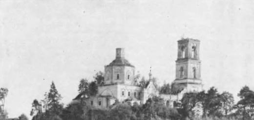
We have listed all the cities of the Smolensk land. It remains to be said about the main city of the earth - Smolensk.
It was a beautifully built and decorated city, located on both sides of the Dnieper. By the end of the 12th century it shone with many rich and beautiful churches. The main part of the city and the fortress were located on the left side of the Dnieper, in a hilly area crossed by ditches. The princely palace, according to legend, was located in the present-day Svirskaya Sloboda.
The Smolensk princes contributed to the decoration of the city with churches. Thus, Vladimir Monomakh built the Cathedral of the Assumption of the Virgin Mary in 1161; in 1146, Rostislav Mstislavich built the Church of the Apostles Peter and Paul in the Trans-Dnieper part of the city; Church of St. John the Theologian was built by Roman Rostislavich in 1180, and the latter’s brother David built a magnificent stone church in the name of the Archangel Michael, which in ancient times was considered one of the most beautiful and richest.
In the city itself and in its environs there were several monasteries: 5 versts from the city there was the Bogoroditsky Monastery, in a place called Selishche, then the Otroch Monastery, the monastery of St. Cross and the monastery built by Bishop Ignatius in honor of the position of the Robe of the Virgin Mary.
Not far from the city, the harbor of Smyadyn was known, at a distance from the city “as if in ripening”, where Gleb Muromsky died. Near Smolensk there was the village of Dresenskoye, which was given to the bishop by Rostislav in 1150.
Smolensk was the main city of a vast region, the Grand Duchy of Smolensk; it is located in an extremely visible location. The route from the Ozernaya region to the middle and lower Dnieper region ran through it, from where to Greece, the route from the Volga region and the upper Dnieper region. This connection of three important trade routes indicates the commercial importance of Smolensk.
From the book Alternative to Moscow. The Great Duchies of Smolensk, Ryazan, Tver author Shirokorad Alexander BorisovichChapter 8 The Death of the Smolensk Principality It has often happened in history that the small personal affairs of rulers had a decisive influence on the fate of peoples. So, after the invasion of Tokhtamysh in 1382, Prince Dmitry Donskoy sent his eldest son Vasily as a hostage to the Horde. Through
authorChapter 3. Non-Slavic peoples of the 9th - early 13th centuries. The Old Russian state, having included in its composition certain non-Slavic ethnic groups, nevertheless remained predominantly Slavic, and along with it there were various peoples of other ethnicities who were
From the book History of Russia from ancient times to the end of the 17th century author Bokhanov Alexander NikolaevichChapter 8. Culture of Rus' X - early XIII centuries. § 1. How the culture of Rus' was born The culture of a people is part of its history. Its formation and subsequent development are closely related to the same historical factors that influence the formation and development of the country’s economy,
From the book Kievan Rus and Russian principalities of the 12th -13th centuries. author Rybakov Boris AlexandrovichChapter six. Russian principalities of the 12th - early 13th centuries
From the book History of Belarus author§ 3. HISTORY OF THE SMOLENSK PRINCHITY The other two principalities - Smolensk and Turov - did not achieve such social development. After the death of Yaroslav, Smolensk was in the possession of his son Vsevolod, and then his grandson Vladimir Vsevolodovich, but then had no significance
From the book Foreign Policy Factors in the Development of Feudal Rus' author Kargalov Vadim Viktorovich From the book Rus' and the Mongols. XIII century author Team of authorsCities and principalities What cities, principalities and lands existed in Rus' at that time? Why and how did the picture of the structure of the Russian land change from year to year? BELOZE? RSKE PRINCE? CRUELTY - in the 13th–14th centuries. appanage of the Rostov principality. It was allocated in 1238 under Prince Gleb Vasilkovich.
From the book Historical Geography of the Golden Horde in the XIII-XIV centuries. author Egorov Vadim LeonidovichTerritory and borders of the state in the 13th century. Throughout the XIII century. the territory of the Golden Horde did not undergo any special changes in the direction of expansion or contraction, and the borders of the state during this period were quite stable. This does not at all indicate that
author From the book History of Spain IX-XIII centuries [read] author Korsunsky Alexander Rafailovich From the book History of Spain IX-XIII centuries [read] author Korsunsky Alexander Rafailovich From the book Borderlands in the system of Russian-Lithuanian relations of the late 15th - first third of the 16th century. author Krom Mikhail MarkovichChapter One Cities of Lithuanian Rus in the political system of the Grand Duchy Adhering to the same order of presentation as in the first part, we will begin by studying the position of Russian (East Slavic) cities in the Grand Duchy of Lithuania, and then move on to analyzing them
From the book The Grand Duchy of Lithuania author Levitsky Gennady MikhailovichInclusion of the western lands of Rus' (the territory of modern Belarus) into the Grand Duchy of Lithuania (XIII - XIV centuries) 1. The appearance of Lithuanian princes in the Novogorod land Novogorod was first mentioned in the Ipatiev Chronicle in 1235. However, as shown
From the book History of Russia from ancient times to the end of the 17th century author Sakharov Andrey NikolaevichChapter 8 Culture of Rus' X - beginning of XIII century § 1. How the culture of Rus' originated The culture of a people is part of its history. Its formation and subsequent development are closely related to the same historical factors that influence the formation and development of the country’s economy, its
author Dovnar-Zapolsky Mitrofan ViktorovichChapter 4. Territory and cities of the Principality of Polotsk To the west of the Smolensk Krivichi lived their relatives, the Polotsk Krivichi. They also became an independent lot early on. The boundaries of this principality can be determined as follows. In the east, the Polotsk border was adjacent to
From the book Essay on the history of the Krivichi and Dregovichi lands until the end of the 12th century author Dovnar-Zapolsky Mitrofan ViktorovichChapter 5. Territory and cities of the Principality of Turov Let us now move on to defining the boundaries of the Principality of Turov. It did not occupy the entire vast area occupied by the Dregovich settlements. Only the northern border of their region with Polotsk remained fundamentally unchanged, until
Grand Duchy of Smolensk- Russian principality in the upper reaches of the Dnieper, Volga and Western Dvina rivers in the 12th-15th centuries. The capital is the city of Smolensk. The route from the Varangians to the Greeks passed through the principality and was an important source of income for its rulers.
The principality included many famous cities, including: Bely, Vyazma, Dorogobuzh, Yelnya, Zhizhets, Zubtsov, Izyaslavl, Krasny, Krichev, Medyn, Mozhaisk, Mstislavl, Orsha, Rzhev, Rostislavl, Rudnya, Slavgorod, Toropets.
Kyiv period
The Nikon Chronicle under the year 875 reports on the successful campaign of Askold of Kyiv against the Krivichi. In 882, before capturing Kyiv, Oleg the Prophet installed his governors in Smolensk. The first Smolensk governor from the Rurik dynasty was Stanislav Vladimirovich. According to the will of Yaroslav the Wise, in 1054 Vyacheslav Yaroslavich became the prince of Smolensk, who died three years later, after which Igor Yaroslavich was transferred from Volyn to Smolensk by the senior Yaroslavichs. He died in 1060, and the tributes from the Smolensk land were divided into three parts by the three senior Yaroslavichs.
The chronicle news that Vladimir Monomakh, having taken the Kiev throne in 1113, transferred his son Svyatoslav from Smolensk to Pereyaslavl, shows the Smolensk land under the rule of Monomakh in the period after the Lyubech Congress of 1097.
XII-XIII centuries
During the reign of Mstislav the Great (1125-1132), the Smolensk throne was given to his son Rostislav, who was able to stay in Smolensk during the period of strife in 1132-1167 and became the founder of the dynasty of Smolensk princes Rostislavich. If Rostislav Mstislavich adhered to a defensive strategy (1155) and received the reign of Kiev through the efforts of his Volyn and Galician allies (1159, 1161), as the eldest in the Monomakhovich family, then his sons and grandsons turned the principality into the base of their influence in all parts of Rus': the most noticeable were the exit of the Rostislavichs from subordination to Andrei Bogolyubsky (1172), assistance to the opponents of the younger Yuryevichs (1174-1175) and Konstantin Vsevolodovich (1216) during the struggle for power in the Vladimir-Suzdal principality, as well as a successful series of campaigns (the inspiration and organizer of which was the famous Mstislav Udatny ), directed against the Chud (1212, 1214), who established the influence of the Smolensk princes in Kiev (1214) and Galich (1215, 1219) and opposed the seizures of the Order of the Swordsmen in the Baltic states (1217, 1219).
The reign of Mstislav Davydovich (1219-1230) also saw the strengthening of the Smolensk Principality, associated with the situation in the Principality of Polotsk. Lithuania's attack on it began in the 12th century. The constant raids were supplemented by defeats from the German knights of the Order of the Sword. As a result, Polotsk lost a number of lands in Livonia (Principality of Gersik, Principality of Kukeinos). At the same time, the influence and authority of the Smolensk princes, who are also at war with Lithuania, are growing in it. After the death of Vladimir of Polotsk in 1216, his principality weakened, and discord began between the appanage princes. The weakening of Polotsk was unprofitable for its neighbors - Novgorod and Smolensk. And then, in order to end the unrest in the Polotsk Land, in 1222 Mstislav Davidovich introduced Smolensk troops into the Polotsk Land, took Polotsk and placed Svyatoslav Mstislavich, the eldest son of Mstislav Romanovich of Kyiv, on the princely table.
The Battle of the Kalka River (1223) undermined the military capabilities of the Smolensk princes, and in subsequent decades the importance of the Smolensk principality fell; for successful defense against Lithuania, it was forced to resort to the help of the Vladimir-Suzdal principality in 1225 (Battle of Usvyat), 1239, 1244-1245 . In 1230, an earthquake occurs, then famine lasts for two years. The consequence of the famine was a pestilence that claimed a very large number of lives in all the towns of the volost. After the death of Mstislav Davydovich, Svyatoslav Mstislavich of Polotsk took Smolensk in 1232 and killed many townspeople hostile to him. During the Mongol invasion, the eastern regions of the principality suffered, but Smolensk survived. In 1239, Vsevolod Mstislavich, another son of Mstislav the Old, was seated on the Smolensk table by Yaroslav Vsevolodovich of Vladimir.
From the end of the 12th century, trade between Smolensk and Riga and Visby on Gotland expanded. The main export item was wax, followed by honey and furs. Imports consisted mainly of cloth; later sources also mention stockings, ginger, candied peas, almonds, smoked salmon, sweet wines, salt, and spurs.
Mongol-Tatar yoke
In 1274, Khan of the Golden Horde Mengu-Timur sent troops to help Leo of Galicia against Lithuania. The Horde army marched west through the Smolensk principality, with which historians attribute the spread of Horde power to it. In 1275, simultaneously with the second census in North-Eastern Rus', the first census was carried out in the Smolensk principality.
In the second half of the 13th century, the Smolensk princely dynasty, the descendants of Gleb Rostislavich, established itself in Bryansk. However, throughout the entire time there were strong sentiments to “have your own prince” and be autonomous from Smolensk. The chronicle even reports that in 1341 the inhabitants of Bryansk killed their unloved Prince Gleb, who came from Smolensk. Bryansk was eventually captured by the Lithuanian prince Olgerd in 1356, who took advantage of the city's turmoil.
At the end of the 13th century, Vyazma was separated from the principality, and appanage tables appeared in Mozhaisk, Fominsky town, Vyazma, Khlepen, Berezuy (Field) and other cities. All of them began as border fortresses, along with Moscow, separating Smolensk and Vladimir, later becoming independent cities. In 1303, Daniil Alexandrovich of Moscow took possession of Mozhaisk. Ivan Alexandrovich entered into an alliance with Gediminas and refused to pay tribute to the Golden Horde, which resulted in a joint campaign against Smolensk by Moscow, Ryazan and Horde troops in 1340. In 1345 Olgerd moved to liberate Mozhaisk, but failed. In 1351 Semyon Ivanovich Proud moved to Smolensk with the Moscow army; he forced the Smolensk people to “stand aside” from the union with Lithuania. In 1355 Olgerd captured Rzhev, after which all relations between Smolensk and Lithuania were disrupted. And although in 1370 the Smolensk princes took part in Olgerd’s second campaign against Moscow, after the patriarch’s appeal to them they declared themselves “helpers” of Moscow, in 1375 they, together with Dmitry Donskoy, went to Tver and took part in the Battle of Kulikovo in 1380.
Under the Smolensk prince Svyatoslav Ivanovich and his successors, despite all efforts to delay the collapse of the principality, it increasingly found itself sandwiched between Moscow and Lithuania. Some of the Smolensk princes began to move to the service of the strong Moscow prince, for example, Fyodor Konstantinovich Fominsky.
In 1386, in a battle near Mstislavl, Vitovt defeated the Smolensk regiments and began to plant princes he liked in Smolensk. In 1395, Vytautas besieged Smolensk, took it by storm, captured the local prince and installed his governors in the city.
In 1401, the Smolensk princes managed to return the appanage table, but not for long - in 1404 Vitovt reoccupied Smolensk and finally annexed it to Lithuania. From that time on, the independence of the Smolensk principality was ended forever, and its lands were included in Lithuania.