Ecuador is located in the very center of the world. Everyone who comes to this country rushes to the city of San Antonio, which is located near Quito, the capital of Ecuador. Here is a monument symbolizing the Middle of the World. Right under the feet of tourists is the red line of the equator. That is, with one foot they are in the southern hemisphere, where it is winter, and the other in the northern hemisphere, where it is summer. Do you feel the difference when you stand like this, spread out over two worlds? Tourists say no! And the locals feel the difference.
Equator- the main attraction of Ecuador, which is named after this imaginary line that divides the surface of the globe into the southern and northern hemispheres. The main landmark segment is located north of the capital Quito in the town of San Antonio de Pichincha. Everything works here so that a person can realize the greatness of the moment - here it is zero latitude, or, as the Incas used to say, Intinyan. This name, according to some sources, is translated as “the road of the sun”, and some translate it as “the parking lot of the sun”. But as it turned out, there is not one or even two parking lots near the sun, and each has its supporters.

Three hundred meters from the first, main place of designation of the equator - the Middle of the World, there is a museum where another line passes. As the owner of the Intignan Museum Fabian Veira says, he has concrete evidence that his line is more precisely defined. He places a portable sink along the equator line No. 2, pours out a bucket of water and, for clarity, throws in a few leaves. Water goes vertically down without forming a funnel. Fabian then moves the shell to the right of his equatorial line, to the southern hemisphere, and repeats the action. Leaves in the southern hemisphere begin to curl clockwise. Independent experiments can be carried out on a stone - an indicator of the equator, where a nail is driven in. Fabian gives a raw egg and offers to set it on a nail head. The egg does not fall. It's so easy to make tourists believe in your theory! Fabian explains this by the fact that on the equator line, the mutual annihilation of the forces of inertia of Cariolis occurs and the terrestrial forces of gravity decrease. This allows the egg to be balanced so that it rests easily on the head of the nail. But Fabian does not let up and invites tourists to walk along the equator line with their eyes closed. The force of gravity will pull you to the southern, then to the northern hemisphere. And yet - on the equator line, you will weigh a kilogram less!
Cristobal Cobo, director of the Kitsato scientific project for the study of the modern, real equator, claims that there is a real, scientifically based equator line that was drawn not so long ago.
Cristobal Cobo:“Experiments with egg, shell and water are all tricks for tourists. There are modern instruments that indicate that the real equatorial line now passes here - where it is drawn according to the latest scientific data.
In the center of the Kitsato project, you can check everything yourself: stand on the freshly painted line and turn on the JPS. The system indicates that the zero parallel passes exactly where you are standing - a few kilometers from the first two lines. Cristobal explains this by saying that over time, the poles shift, and the equator follows them. This is a natural process of change and development of the planet. Everyone has the right to choose their own middle of the world.

The only thing that remains unchanged here is that throughout the whole country the sun rises and sets at the same time all year round. Here day equals night, and at noon objects never cast a shadow. And there are no seasons in Ecuador as such. And this is possible only at the equator. The equator occupies only five percent of the land. But there is a very rich flora and fauna.

Ecuador has 11 National Parks, 9 reserves, 4 biological reserves, 1 geobotanical reserve and 10 protected natural areas.
El Cajas National Park in Asuay Province. It was founded in 1996 in the west of the country and has an area of 285.4 square kilometers. Translated from Spanish as "gate to the mountains." Here you can see about 300 fantastic mountain lakes, lagoons and waterfalls. You need to drive carefully - alpacas (llamas) periodically jump out onto the road. Llama wool makes very warm sweaters that protect well from mountain winds. The higher the mountains, the more dizzy from lack of oxygen. It gets cold and very windy. The temperature at an altitude of 4000 meters drops to +4 degrees.

Ecuador's highest point - extinct Chimborazo volcano(Spanish Chimborazo). Its height is 6267 meters, according to some sources - 6310 m. Once, before the beginning of the 19th century, the Chimborazo volcano was considered the highest peak on Earth. Now it cannot be compared with the highest Himalayan peaks, but so far the Chimborazo volcano is the most distant point on the surface from the center of the Earth.
The material is partially taken from the program: “My planet. With Anastasia Chernobrovina"
Photo: Len Langevin, Delphine Ménard and also from the Internet. For questions about authorship, please contact the office of the company
We all live on the beautiful planet Earth, about which mankind has already learned a lot, but even more is still hidden from us and is waiting in the wings until a person’s desire for knowledge reveals all the secrets of our world.
General information about the planet Earth
Let's remember what we know about planet Earth. The Earth is the only inhabited planet in our solar system, in fact, the only one on which there is life. The Earth is the third planet in a row, if you count from the Sun, before the Earth there are two more planets Mercury and Venus. The Earth rotates around the Sun and the tilt of the axis of rotation relative to the Sun is 23.439281 °, thanks to this tilt we can observe the change of seasons throughout the year. The distance from the earth to the sun is 149,600,000 km, in order for a stream of light to overcome the distance from the Sun to the Earth, it needs 500 seconds or 8 minutes. Our planet also has a satellite, the Moon, which revolves around the Earth, just as the Earth revolves around the sun. The distance from the Earth to the Moon is 384400 km. The speed of the Earth in its orbit is 29.76 km/sec. The Earth makes a complete revolution on its axis in 23 hours 56 minutes and 4.09 seconds. For convenience, it is considered that there are 24 hours in a day, but in order to compensate for the remaining time in the calendar, one more day is added every 4 years and this year is called a leap year. A day is added in the month of February, which usually has 28 days, in a leap year 29 days. There are 365 days in a year and 366 days in a leap year, this is a full cycle of seasons (winter, spring, summer, autumn).
Earth dimensions and parameters
Now let's fast forward from space to the planet Earth itself. In order for life to arise on the planet, there must be many factors and conditions that create a favorable habitat for countless living organisms inhabiting the Earth. In fact, the more we learn about our common home, the more clearly we understand how complex and perfect the planet Earth is. There is nothing superfluous, everything has its place, and everyone has an important role to play.

The structure of the planet Earth
In total, there are 8 planets in our solar system, 4 of which belong to the terrestrial planets and 4 to the gas group. Planet Earth is the largest terrestrial planet and has the largest mass, density, magnetic field and gravity. The structure of the Earth is not homogeneous, and conditionally it can be divided into layers (levels): the earth's crust; mantle; nucleus.
Earth's crust
- the uppermost layer of the solid shell of the Earth, it, in turn, is divided into three layers: 1) sedimentary layer; 2) granite layer; 3) basalt layer.
The thickness of the earth's crust can be in the range of 5 - 75 km deep into the Earth. Such a run-up depends on the places of measurements, for example, at the bottom of the ocean, the thickness is minimal, and on the continents, on mountain ranges, the maximum. As we have already said, the earth's crust is divided into three parts, the basalt layer was formed first, therefore it is the lowest, followed by the granite layer, which is absent from the ocean floor, and the uppermost sedimentary layer. The sedimentary layer is constantly formed and modified, and man plays an important role in this.
Mantle
- the layer following the earth's crust, which is the most voluminous, about 83% of the total volume of the Earth and approximately 67% of its mass, the mantle thickness reaches 2900 km. The upper layer of the mantle, which is 900 km, is called magma. Magma is molten minerals, also the output of liquid magma is called lava.
Nucleus
- this is the center of the planet Earth, it consists mainly of iron and nickel. The radius of the earth's core is about 3500 km. The core is also divided into an outer core with a thickness of 2200 km, it has a liquid structure and an inner core with a radius of about 1300 km. The temperature in the center of the nucleus is close to 10,000 °C; on the surface of the nucleus, the temperature is well below 6,000 °C.

Earth shape. Earth diameter. The mass of the earth. Age of the Earth.
If you ask the question, “What is the shape of the Earth?”, We will hear the answer options: round, ball, ellipsoid, but this is not entirely true, a special term Geoid was introduced to denote the shape of the Earth. The geoid is essentially an ellipsoid of revolution. Determining the shape of the planet made it possible to accurately determine the diameters of the planet Earth. Yes, it is the diameters of the Earth due to the irregular shape that they are distinguished by several:
1) the average diameter of the Earth is 12,742 km;
2) the equatorial diameter of the Earth is 12756.2 km;
3) the polar diameter of the Earth is 12713.6 km.
 The circumference along the equator is 40,075.017 km, and along the meridian is slightly less than 40,007.86 km.
The mass of the Earth is quite a relative value, which is constantly changing. The mass of the earth is 5.97219 × 10 24 kg. The mass increases due to the settling of cosmic dust on the surface of the planet, the fall of meteorites, etc., due to which the mass of the Earth annually increases by about 40,000 tons. But due to the dispersion of gases into outer space, the mass of the Earth is reduced by about 100,000 tons per year. Also, the loss of mass of the Earth is affected by an increase in temperature on the planet, which contributes to more intense thermal movement and leakage of gases into space. The smaller the mass of the Earth becomes, the less its attraction and the more difficult it becomes to keep the atmosphere around the planet.
Thanks to the method of radioisotope dating, scientists managed to establish the age of the Earth, it is 4.54 billion years. The age of the Earth was more or less accurately determined back in 1956, subsequently, with the development of technologies and measurement methods, it was slightly corrected.
Other information about the planet Earth
The surface area of the Earth is 510,072,000 km², of which 361,132,000 km² are covered by water, which is 70.8% of the Earth's surface. The land area is 148,940,000 km², which is 29.2% of the Earth's surface area. Due to the fact that water covers much more of the surface of the planet, it was more logical to call our planet Water.
The volume of the Earth is 10.8321 x 10 11 km³.
The highest point on the earth's surface above sea level is Mount Everest, which is 8848 m high, and the deepest place in the world's oceans is the Mariana Trench, its depth is 11022 m. Well, if we give average values, then the average height of the Earth's surface above sea level is 875 m , and the average depth of the ocean is 3800 m.
Acceleration of free fall, it is also the acceleration of gravity in different parts of the planet will be slightly different. At the equator g= 9.780 m/s² and gradually increases, reaching g=9.832 m/s² at the poles. The average value of the gravitational acceleration is assumed to be g = 9.80665 m/s²
The composition of the atmosphere of planet Earth: 1) 78.08% nitrogen (N2); 2) 20.95% oxygen (O2); 3) 0.93% argon (Ar); 0.039% - carbon dioxide (CO2); 4) 1% water vapor. Other elements from Mendeleev's periodic table are also present in small amounts.
Planet Earth is so big and interesting that, despite how much we already know about the Earth, it never ceases to amaze us with those mysteries and unknowns that we continue to face.

Where does the equator pass and what is it, what is its duration and why did scientists even need to invent this imaginary line. Let's talk about all this in more detail.
In contact with
Concept definition
The equator is a conditional line that runs exactly through the center of our planet. Geographic latitude of the equator- 0 degrees. It serves as a reference point and enables scientists to carry out various calculations, which will be discussed below. The equator divides the globe into two absolutely equal parts.
Important! In the territories along which the equator passes, the night is always equal to the day, without deviation even for a fraction of a second.
The equatorial zone receives the most ultraviolet rays. Therefore, the farther the point is from the conditional line, the less heat and light it receives. That is why the highest temperature indicators were registered in the region of the conditional line.
Purpose
To conduct various calculations, scientists need to designate the special separators of the planet, which are the equator, parallels and meridians.
These conditional lines allow you to determine the position of various objects, enable aircraft to navigate in, and ships - to.
In addition, it is this band that allows scientists to divide the entire territory of the planet into climatic zones or belts.
In fact, the circumference of the equator is a key metric characteristic that is taken into account. It helps not only in such sciences as geodesy or elementary geography, but also in astrology and astronomy.
There are currently fourteen countries on the equator. The political map of the world is constantly changing: countries appear and disappear, their borders can expand or shrink. What states are we talking about?
- Brazil,
- Ecuador,
- Indonesia,
- Maldives and other countries.
What is the circumference of the earth at the equator
According to the most accurate calculations, the length of the equator per kilometer is 40075 km. But the length of the Earth's equator in miles reaches 24901 miles.
As for such a thing as radius, it can be polar and equatorial. The dimensions of the first in kilometers reach 6356, and the second - 6378 km
 All areas in close proximity to this imaginary line have a warm and humid climate.
It is no coincidence that life in these areas is simply seething. This is where most of the variety of plant and animal species.
Equatorial forests are considered the densest in the world, and some of them are completely impenetrable wilds, even taking into account all modern scientific achievements.
Precipitation in the equatorial zone is almost daily and very plentiful. That is why everything that is and grows here shines with a wide variety of colors.
On the planet there is a volcano named Wolf. So, the fact is that it is currently active and, interestingly, is located on both sides of the conditional line.
Attention! The average annual temperature in this area reaches 25-30 degrees Celsius.
The high temperature all year round makes the countries that are in this region an ideal holiday destination for tourists. This is especially true of the popular resorts located in the Maldives, where millions of tourists from all over the world come every year.
Important! There is a glacier at the equator. It is located at an altitude of 4690 meters on the slope of a volcano called Cayambe.
 This is an amazing place, especially for. The fact is that the speed of rotation of the Earth on this conditional line reaches more than 460 meters per second.
The speed of sound at the same time reaches only 330 meters per second. Consequently, any spacecraft that are launched from here will already, as it were, start at supersonic speed.
We talked about how long the equator is, what role it plays in modern human life. As many as three countries are named in his part.
Without this imaginary line, there would be no way for people to pinpoint the location of the island or even famous city. All planes and ships are guided by a conditional map of latitudes, parallels, where the key place is played by a line that crosses the Earth in exactly two halves.
A river called the Congo crosses the median line of the Earth as many as twice.
What is the equator, its characteristics
Calculate the length of the Earth's equator
Conclusion
The equator is 40,075 kilometers long. So that you can appreciate how huge this is, let's compare it with the mileage of an ordinary car. On average, it takes a typical Nissan Juke three years to cover that distance. This line divides the planet into the northern and southern hemispheres. It is here that the wettest regions of the planet are located, where the largest number of species of animals and plants, which we used to call exotic, are concentrated. It is here, in countries with a very warm climate, that the largest number of tourists come.
Due to the spherical shape of the planet, this parallel is the longest.
2. In a different way, the equator is a conditional line that runs exactly in the center of our planet. And it is she who is the longest road on Earth.
3. The line of the equator is longer than its counterpart, passing through the poles. The reason for this lies in the shape of our planet, which is slightly flattened due to rotation around its axis.
5. For scientists, the diameter of the Earth is of practical importance. It is calculated by knowing the circumference of the planet at the equator.

6. For the first time, the length of the equator was calculated by the ancient Greek mathematician and astronomer Erastofen of Cyrene, and almost exactly. According to his data, the length of the earth's meridian is 250,000 stadia, that is, 40,000 kilometers. The exact length of the equator is 40,075,696 meters.
7. To walk the Earth on foot along the equator, you will need to overcome 40,075 km. The average walking speed is 6 km/h. If we substitute these values into the formula, it will come out: 40075/6=6679 hours. After the transfer per day, it turns out 278.
8. No one goes without stops. If you travel 6 hours a day, you will need 4 times more time - 1112 days. This will be 3 years.
9. The calculations are hypothetical, because the equator crosses the land only through America, Africa, the Indonesian Islands. The rest of the way lies through the oceans: Atlantic, Indian, Pacific.
10. There are 14 countries at the equator. But there is no traveler in the world who has managed to cross all these countries along the equator.

ECUADOR
11. The name of the Latin American country Ecuador is translated from Spanish as "equator".
12. The equator line does not cross the territory of the country called Equatorial Guinea, despite its name.
13. Almost in all equatorial countries, except for Gabon and Somalia, commemorative signs have been erected in honor of the zero parallel. The most beautiful are in Brazil and Ecuador.
14. Zero parallel crosses 33 islands. Of these, 17 - the territory of Indonesia.
15. Some of the islands are not oceanic: 2 - in a lake on the Indonesian island of Kalimantan, 9 - at the mouth of the Amazon River, 5 more - on the African Lake Victoria.

16. The major international geographic organizations have adopted a symbolic representation of the equator in the shape of a circle.
17. The equator is the most important landmark for navigation - its latitude is 0 degrees, so the measurement of parallels comes from it.

18. The Equator is one of the five most important latitudes for navigation, which are considered generally accepted in the geographical community. Four others: the Arctic Circle; the southern polar circle; Tropic of Cancer; Tropic of Capricorn.
19. The equator divides our planet into two almost equal hemispheres - Northern and Southern. Why "almost"? Because the shape of the Earth is not a perfect ball.

21. If we take scientific concepts and figures, then the Earth is not a perfect ball; in the world of experts, its shape is described by the concepts of geoid or ellipsoid.
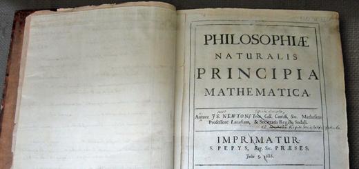
22. Isaac Newton and Christian Huygens discovered not the ideal shape of our native planet back in the 17th century. Due to rotation around its axis and the resulting centrifugal force, which reaches a peak at the equator and zero at the poles, the planet is more like an oblate ball. Because of this, the polar radius is less than the equatorial one by 21.38 kilometers.

23. The planet reaches its highest rotation speed at zero latitude. This fact is easily explained by the maximum radius of the Earth at the equator.
24. So the length of the equator is 40,075 kilometers, and if this number is divided by 24 hours (the time it takes the planet to complete one revolution), then you can find out the speed of rotation of the Earth at zero latitude. Thus, at the equator, it is approximately 1670 km / h.
25. That is, the speed of rotation of the Earth at the equator reaches 465 meters per second. This is more than the speed of sound, equal to 331 meters. The closer to the poles, the slower the speed.

CONGO RIVER
26. The Congo River, flowing in Central Africa, is the deepest and second longest on the continent. But the most interesting thing about it is that it is the only river in the world that crosses the equator twice.
27. There is a city in Brazil called Macapa. It is located simultaneously in two hemispheres. In the city center there is a football stadium named after Estadio Milton Correa.
28. The center field line of this stadium runs almost exactly along the equator line. Not far from the sports facility there is a monument to “Marco Zero”.
29. Some countries got their name from the word “equator”: Ecuador, Equatorial Guinea, Equatorial Africa.
30. The equator passes through the territories of many countries, however, it is not the hottest area on Earth - some deserts far from it are much hotter.

31. To the north of the equator, when draining, the water twists clockwise, and to the south - against it. And if you drain the water exactly at the equator, the water does not swirl at all.
32. It was in this simple way that sailors in ancient times recorded the intersection of the equator. This is due to the influence of the Coriolis force. Translated from Latin, this word means "to level".

33. In relation to the plane of the orbit, the location of the equator varies in the range of 22-24.5 °. The tilt of the axis is affected by the attraction of the planets and the Sun.
34. Along the equator, day equals night without the slightest deviation. Twice a year at the equinox, the direction of the sun's rays is strictly vertical.
35. On other days, it is not much different, so the equator receives the largest amount of ultraviolet radiation.

36. According to the old maritime tradition, on ships crossing the equator, the sailors of ancient times held the Neptune Festival.
37. To carry out calculations, a conditional division of the planet into parallels and meridians is required. The geographical latitude of the equator is 0°. This is the reference point of all coordinates of the Earth, which divides it into 2 equal halves.
38. Parallels and meridians determine the position of objects. They navigate in the air, on land and water. In addition, there are climatic zones, time zones.

39. The area adjacent to the equator has a humid warm climate. Here, the richest flora and fauna on the planet, dense forests, some areas are impassable.
40. The terms summer, autumn, winter and spring are not usually applied to this climate zone. It is always summer here, the air is hot and humid due to constant evaporation. Summer here lasts a year, the average temperature is +25…+30°С. At night, it is not much different from daytime, so much the earth warms up by the sun. It rains almost every day.
41.The climate attracts tourists, but conditions are not created in all countries. The largest number of vacationers is observed annually in the Maldives; tourists are attracted by the authorities of Ecuador, Brazil, and Kenya.

VOLCANO WOLF
42. The active Wolf volcano is located on the Galapagos archipelago. It is located on both sides of the equator.
43. Not far from the city of Quito (the capital of Ecuador), the Cayambe volcano whitens. Its height is 4690 meters, the slopes are covered with eternal ice.
44. The lowlands at the equator generally have a tropical rainforest climate, also known as an equatorial climate.
45. Average annual temperatures in the equatorial lowlands are around 31°C in the afternoon and 23°C at sunrise.

RAIN ON THE EQUATOR
46.Precipitation levels are extremely high compared to areas more distant from the equator - they can reach from 2500 to 3500 millimeters. There are about 200 rainy days in a year, and the average annual number of hours of sunshine is about 2000.
47. A person uses the physical features of the zero parallel. The earth there rotates 1.4 times faster than the speed of sound. It is advantageous to launch space satellites in this region. They immediately gain supersonic speed, saving 10% of fuel.
48. Communications satellites in space are in geostationary orbit just above the equator, at an altitude of over 35,000 kilometers.
49. Objects moved from the poles to the equator lose 0.53% of their mass due to the effect of centrifugal force and greater distance from the center of our planet.
50. It is the forests growing on the equator that are the “lungs of the Earth”, producing oxygen, which all living things breathe.

EQUATORIAL FORESTS OF AFRICA
photo from open sources
We all live on the beautiful planet Earth, about which mankind has already learned a lot, but even more is still hidden from us and is waiting in the wings until a person’s desire for knowledge reveals all the secrets of our world.
General information about the planet Earth
Let's remember what we know about planet Earth. The Earth is the only inhabited planet in our solar system, in fact, the only one on which there is life. The Earth is the third planet in a row, if you count from the Sun, before the Earth there are two more planets Mercury and Venus. The Earth rotates around the Sun and the tilt of the axis of rotation relative to the Sun is 23.439281 °, thanks to this tilt we can observe the change of seasons throughout the year. The distance from the earth to the sun is 149,600,000 km, in order for a stream of light to overcome the distance from the Sun to the Earth, it needs 500 seconds or 8 minutes. Our planet also has a satellite, the Moon, which revolves around the Earth, just as the Earth revolves around the sun. The distance from the Earth to the Moon is 384400 km. The speed of the Earth in its orbit is 29.76 km/sec. The Earth makes a complete revolution on its axis in 23 hours 56 minutes and 4.09 seconds. For convenience, it is considered that there are 24 hours in a day, but in order to compensate for the remaining time in the calendar, one more day is added every 4 years and this year is called a leap year. A day is added in the month of February, which usually has 28 days, in a leap year 29 days. There are 365 days in a year and 366 days in a leap year, this is a full cycle of seasons (winter, spring, summer, autumn).
Earth dimensions and parameters
Now let's fast forward from space to the planet Earth itself. In order for life to arise on the planet, there must be many factors and conditions that create a favorable habitat for countless living organisms inhabiting the Earth. In fact, the more we learn about our common home, the more clearly we understand how complex and perfect the planet Earth is. There is nothing superfluous, everything has its place, and everyone has an important role to play.
The structure of the planet Earth
In total, there are 8 planets in our solar system, 4 of which belong to the terrestrial planets and 4 to the gas group. Planet Earth is the largest terrestrial planet and has the largest mass, density, magnetic field and gravity. The structure of the Earth is not homogeneous, and conditionally it can be divided into layers (levels): the earth's crust; mantle; nucleus.
Earth's crust
- the uppermost layer of the solid shell of the Earth, it, in turn, is divided into three layers: 1) sedimentary layer; 2) granite layer; 3) basalt layer.
The thickness of the earth's crust can be in the range of 5 - 75 km deep into the Earth. Such a run-up depends on the places of measurements, for example, at the bottom of the ocean, the thickness is minimal, and on the continents, on mountain ranges, the maximum. As we have already said, the earth's crust is divided into three parts, the basalt layer was formed first, therefore it is the lowest, followed by the granite layer, which is absent from the ocean floor, and the uppermost sedimentary layer. The sedimentary layer is constantly formed and modified, and man plays an important role in this.
Mantle
- the layer following the earth's crust, which is the most voluminous, about 83% of the total volume of the Earth and approximately 67% of its mass, the mantle thickness reaches 2900 km. The upper layer of the mantle, which is 900 km, is called magma. Magma is molten minerals, also the output of liquid magma is called lava.
Nucleus
- this is the center of the planet Earth, it consists mainly of iron and nickel. The radius of the earth's core is about 3500 km. The core is also divided into an outer core with a thickness of 2200 km, it has a liquid structure and an inner core with a radius of about 1300 km. The temperature in the center of the nucleus is close to 10,000 °C; on the surface of the nucleus, the temperature is well below 6,000 °C.
Earth shape. Earth diameter. The mass of the earth. Age of the Earth.
If you ask the question, “What is the shape of the Earth?”, We will hear the answer options: round, ball, ellipsoid, but this is not entirely true, a special term Geoid was introduced to denote the shape of the Earth. The geoid is essentially an ellipsoid of revolution. Determining the shape of the planet made it possible to accurately determine the diameters of the planet Earth. Yes, it is the diameters of the Earth due to the irregular shape that they are distinguished by several:
1) the average diameter of the Earth is 12,742 km;
2) the equatorial diameter of the Earth is 12756.2 km;
3) the polar diameter of the Earth is 12713.6 km.
The circumference along the equator is 40,075.017 km, and along the meridian is slightly less than 40,007.86 km.
The mass of the Earth is quite a relative value, which is constantly changing. The mass of the earth is 5.97219 × 10 24 kg. The mass increases due to the settling of cosmic dust on the surface of the planet, the fall of meteorites, etc., due to which the mass of the Earth annually increases by about 40,000 tons. But due to the dispersion of gases into outer space, the mass of the Earth is reduced by about 100,000 tons per year. Also, the loss of mass of the Earth is affected by an increase in temperature on the planet, which contributes to more intense thermal movement and leakage of gases into space. The smaller the mass of the Earth becomes, the less its attraction and the more difficult it becomes to keep the atmosphere around the planet.
Thanks to the method of radioisotope dating, scientists managed to establish the age of the Earth, it is 4.54 billion years. The age of the Earth was more or less accurately determined back in 1956, subsequently, with the development of technologies and measurement methods, it was slightly corrected.
Other information about the planet Earth
The surface area of the Earth is 510,072,000 km², of which 361,132,000 km² are covered by water, which is 70.8% of the Earth's surface. The land area is 148,940,000 km², which is 29.2% of the Earth's surface area. Due to the fact that water covers much more of the surface of the planet, it was more logical to call our planet Water.
The volume of the Earth is 10.8321 x 10 11 km³.
The highest point on the earth's surface above sea level is Mount Everest, which is 8848 m high, and the deepest place in the world's oceans is the Mariana Trench, its depth is 11022 m. Well, if we give average values, then the average height of the Earth's surface above sea level is 875 m , and the average depth of the ocean is 3800 m.
Acceleration of free fall, it is also the acceleration of gravity in different parts of the planet will be slightly different. At the equator g= 9.780 m/s² and gradually increases, reaching g=9.832 m/s² at the poles. The average value of the gravitational acceleration is assumed to be g = 9.80665 m/s²
The composition of the atmosphere of planet Earth: 1) 78.08% nitrogen (N2); 2) 20.95% oxygen (O2); 3) 0.93% argon (Ar); 0.039% - carbon dioxide (CO2); 4) 1% water vapor. Other elements from Mendeleev's periodic table are also present in small amounts.
Planet Earth is so big and interesting that, despite how much we already know about the Earth, it never ceases to amaze us with those mysteries and unknowns that we continue to face.